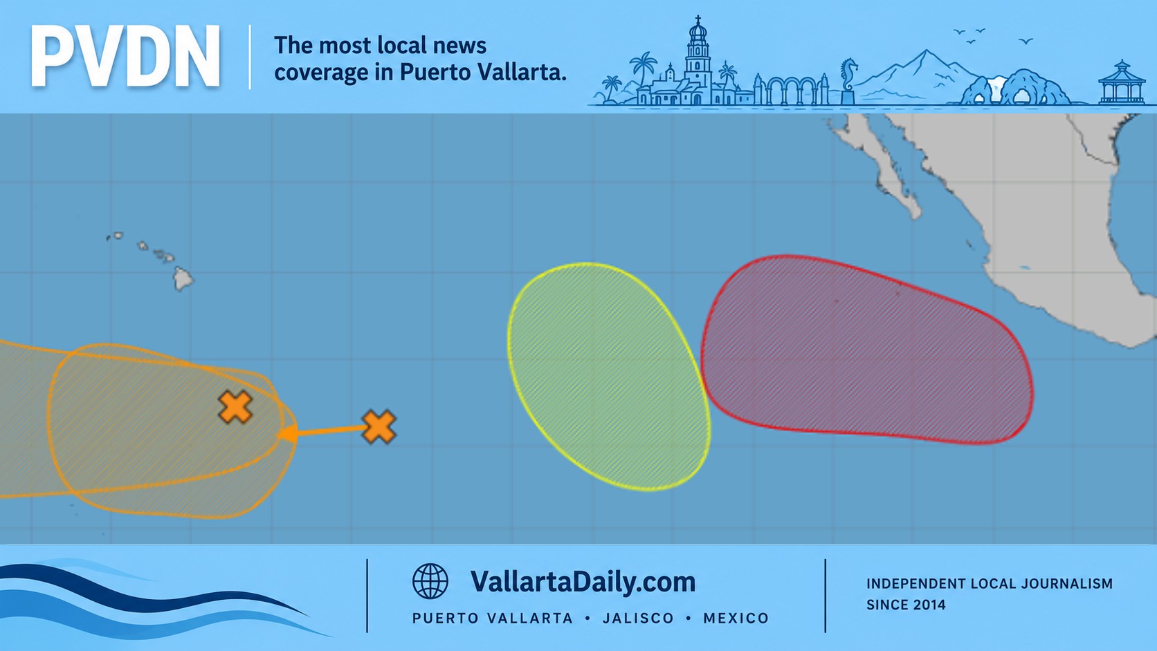
Puerto Vallarta, Jalisco, July 10, 2026 – Puerto Vallarta is entering a wetter Sunday risk window, as the latest National Meteorological Service outlook places parts of western Jalisco at risk of 75 to 150 millimeters of rain. A separate low-pressure area expected offshore carries a 70 percent chance of tropical development next week.
The two signals are connected to a broader unsettled Pacific pattern, but they are not the same event. The SMN Friday bulletin places western Jalisco and southern Nayarit in a 25 to 50 millimeter rain category Friday. It also projects coastal temperatures between 35 and 40 degrees Celsius, gusts reaching 30 to 50 kilometers per hour in parts of Jalisco, and waves between 1.5 and 2.5 meters along the state’s coastline.
Saturday currently looks less widespread, with federal projections showing 5 to 25 millimeters across Jalisco and Nayarit and waves near 1 to 2 meters along the Jalisco coast. Sunday brings the sharper change. The extended federal outlook places western, central and southern Jalisco in the 75 to 150 millimeter category, while Nayarit is listed at 50 to 75 millimeters.
Those ranges apply across broad regions rather than a single city. A thunderstorm can unload heavily over Pitillal, Ixtapa or the mountain corridor while leaving the Hotel Zone or south shore with much less. Even so, western Jalisco’s placement in the highest Sunday category makes runoff, flooded low points and sudden rises in streams the more immediate local concern.
The separate cyclone signal is still several steps away from becoming a named storm. The National Hurricane Center outlook says a low may form late this weekend or early next week several hundred miles south-southwest of southwestern Mexico. Development odds were near zero through 48 hours and 70 percent through seven days, with a west-northwest movement expected.
The same federal update reported no active tropical cyclone in the Eastern Pacific early Friday. No forecast cone, coastal warning, or direct impact on Puerto Vallarta had been issued. A 70 percent chance of development means forecasters consider a tropical depression likely somewhere within the outlined area over the next week. It does not mean a 70 percent chance of landfall near Banderas Bay.
Vallarta Daily’s Friday weather report recorded mostly cloudy skies and a morning temperature near 25 degrees Celsius, with conditions expected to change as daytime heating builds.
Puerto Vallarta does not need a named storm nearby to experience street flooding. A June storm flooded lanes and slowed traffic on Federal 200 , and the city had already begun clearing rivers, streams and canals ahead of the wet season.
Drivers should be ready to change routes quickly if water begins to collect on low sections of Federal 200, Francisco Medina Ascencio, or on roads near canals. Beachgoers should check flags before entering the water, especially near river mouths after heavy rain, while small-vessel operators should review port guidance as coastal swell changes.