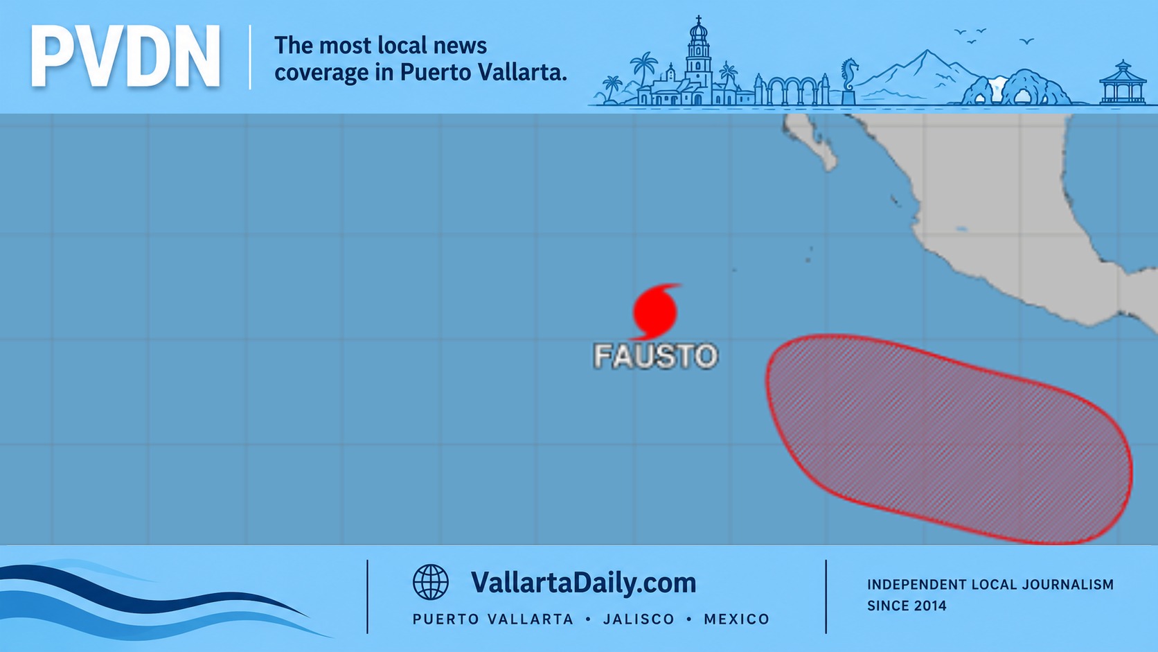
PUERTO VALLARTA (PVDN) – Tropical Storm Hilary, which formed this morning south of the coast of Guerrero, is expected to cause intense punctual rains accompanied by electrical discharges in Oaxaca, Guerrero, and Michoacán, as well as very strong rains in Colima. The storm’s wide circulation is also generating an abundant entry of humidity towards the west and center of the country, generating very heavy rains in Nayarit, Jalisco, and Puebla, and strong rains in the State of Mexico, Mexico City, and Morelos.
The National Weather Service warns of gusts of wind ranging from 70 to 90 km/h and waves from 2 to 4 meters high on the coasts of the affected states, including Puerto Vallarta. Residents in these areas are advised to take precautions and be prepared for possible flooding and landslides.
In addition to the effects of Tropical Storm Hilary, a low-pressure channel in the southeast of the country, in interaction with tropical wave No. 23, will cause punctual intense rains with electric shocks and possible hailstorms in Chiapas, Veracruz, Tabasco, Campeche, and Yucatan, as well as heavy rains in Quintana Roo. The Mexican monsoon and instability in the upper atmosphere will also contribute to heavy occasional rains with electric shocks, gusts of wind, and possible hail in Durango and Sinaloa, intervals of showers in Baja California Sur and Sonora, and isolated rains in Lower California.
For tomorrow, Thursday, Hilary is expected to intensify to a hurricane southwest of the coasts of Colima and Jalisco. Its extensive cloud bands, in interaction with instability in the upper atmosphere, will cause heavy to very strong rains in the western, central, and southern states of the country, including the Valley of Mexico. Strong gusts of wind and high waves are also expected on the coasts of Guerrero, Michoacán, Colima, and Jalisco.
Tropical wave No. 23 will move slowly over the southeast of Mexico, interacting with a low-pressure channel in the southern Gulf of Mexico, and will cause heavy to very heavy rains with electric shocks in Chiapas, Oaxaca, and Veracruz, and intervals of showers in the Yucatan Peninsula. The entry of moisture from the Gulf of Mexico and instability in the upper atmosphere will cause rains with intervals of showers in the northeast of the country.
Finally, the National Weather Service advises residents to take precautions for the very hot to extremely hot environment that will continue, with maximum temperatures above 40 °C over the northwest, north, and northeast states of the Mexican Republic.
PUERTO VALLARTA (PVDN) - Tropical Storm Hilary, which formed this morning south of the coast of Guerrero, is expected to cause intense punctual rains accompanied by electrical discharges in Oaxaca, Guerrero, and Michoacán, as well as very strong rains in Colima. The storm's wide circulation is also generating an abundant entry of humidity towards the west and center of the country, generating very heavy rains in Nayarit, Jalisco, and Puebla, and strong rains in the State of Mexico, Mexico City, and Morelos.
The National Weather Service warns of gusts of wind ranging from 70 to 90 km/h and waves from 2 to 4 meters high on the coasts of the affected states, including Puerto Vallarta. Residents in these areas are advised to take precautions and be prepared for possible flooding and landslides.