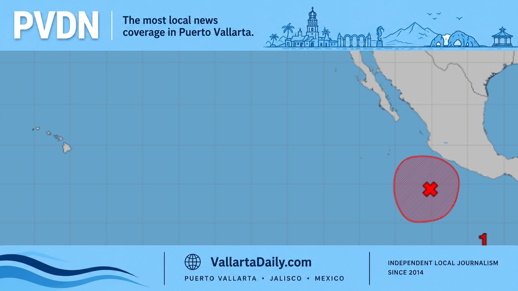
Puerto Vallarta, Jalisco, Sept. 21, 2026 — Tropical Storm Polo strengthened south of Mexico early Monday and could become a major hurricane Tuesday, raising rain, surf and flooding risks in Puerto Vallarta.
At 6 a.m. Central Time, Polo’s sustained winds had reached 50 mph. Its center was 240 miles south of Manzanillo, moving northeast at 5 mph, according to the latest National Hurricane Center update.
Puerto Vallarta was not under a tropical storm watch. Mexico’s watch extended from Tecpan de Galeana, Guerrero, to Punta San Telmo, Michoacán.
The direct risk to Puerto Vallarta
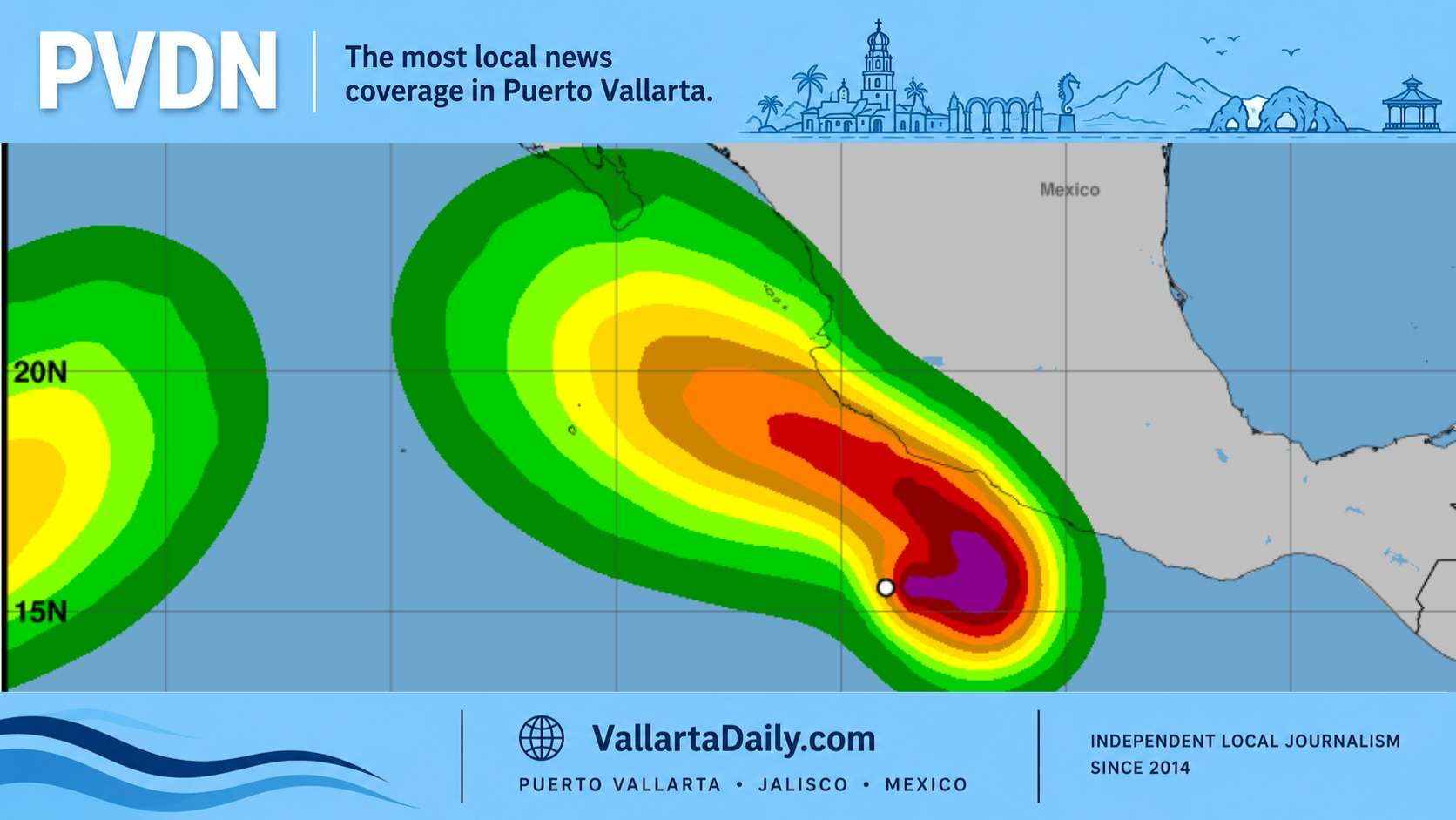
Our review of the official track found no forecast landfall in Puerto Vallarta. The hurricane center expects Polo’s core to remain offshore as it approaches southwestern Mexico.
The forecast issued at 3 a.m. Monday calls for Polo to become a hurricane later Monday and a major hurricane Tuesday. It projects Category 4 winds of 145 mph near the center Wednesday and Thursday.
The forecast point for midnight Friday is 18.7 degrees north and 106.6 degrees west. Our calculation places that point about 260 kilometers, or 162 miles, southwest of Puerto Vallarta.
That calculation is a straight-line distance from a forecast coordinate. It is not a wind forecast for the city.
Polo’s tropical-storm-force winds extended up to 60 miles from its center Monday morning.
The forecast discussion said model solutions differed on where and when Polo would turn northwest. Forecasters said, “confidence in the details of the track forecast is quite low.”
The current advisory does not state that hurricane-force winds will reach Puerto Vallarta. Its hazard outlook places coastal Jalisco within the regional rainfall area and swell zone.
Rain could aggravate known flood points
The hurricane center forecasts 4 to 8 inches of rain through Thursday across coastal parts of Jalisco, Colima and Michoacán. Isolated regional totals could reach 12 inches, or about 305 millimeters.
Those totals cover a broad stretch of coastline. They are not a forecast of 12 inches for Puerto Vallarta.
Jalisco’s state Civil Protection monitoring unit separately estimated 100 to 150 millimeters, or about 4 to 6 inches, through Thursday. Its risk bulletin placed the highest totals mainly in the Costa Sur and mountain regions.
For Monday, Mexico’s National Meteorological Service forecast 25 to 50 millimeters in parts of Jalisco. Its national forecast warned that heavy rain could cause street flooding, river rises, and landslides.
Puerto Vallarta already has documented trouble spots during heavy rain. Municipal risk records identify Avenida Francisco Medina Ascencio at Politécnico Nacional and several sections of state Highway 544.
Other recurring sites include Avenida Palma Areca, Avenida Independencia, and Paso del Guayabo. Calle Quimixto in Portales and areas of Las Juntas, Bobadilla and La Floresta also have histories of flooding.
The same local risk inventory calls for monitoring the Cuale and Pitillal rivers. It also identifies the Virgen, Contentillo, Rastro, and Poetas channels.
These locations are established seasonal hazards, not reports of current flooding caused by Polo. Drivers should not cross moving water or enter a flooded underpass or street.
Higher surf is forecast along Jalisco’s coast
Mexico’s weather service forecasts long-period swell along Jalisco’s coast Monday. Waves could reach 1.5 to 2.5 meters, or about 5 to 8 feet. The hurricane center expects Polo-generated swells to begin reaching southwestern Mexico on Tuesday.
The federal forecast warns that those swells can produce dangerous surf and rip currents. The 1.5-to-2.5-meter range applies to the Jalisco coast and is not a beach-by-beach forecast inside Banderas Bay.
The statewide range does not establish identical conditions at Playa de Oro, Camarones, Los Muertos or Conchas Chinas. It also does not provide a separate forecast for beaches south of Boca de Tomatlán. Swimmers should follow the flag posted by lifeguards at each beach.
Puerto Vallarta Civil Protection said in a local monitoring notice that it was maintaining special attention on Polo’s development. The city remained outside the official cyclone watch area in the latest information reviewed for this report.
Warm water supports rapid strengthening
The hurricane center cited ocean temperatures above 86 F, low wind shear, and high atmospheric moisture. Its rapid-intensification guidance showed nearly a 90% chance of a 63 mph wind increase within 48 hours.
Polo is expected to drift east or southeast before making a sharp turn toward the west-northwest or northwest late Tuesday. Forecasters linked the wide model spread to that complex steering pattern.
Polo developed from the system covered in PVDN’s earlier report on Seventeen-E. State and municipal authorities advised residents to monitor official updates. Residents should avoid rivers, streams, and flooded roads during hazardous conditions.