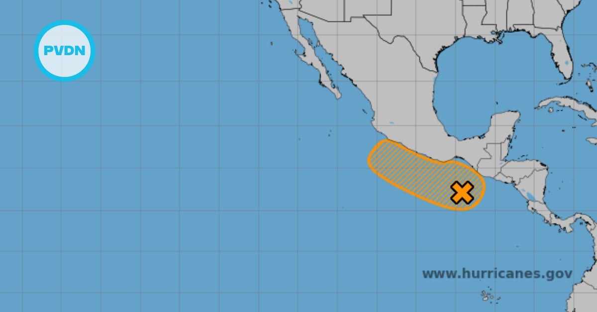
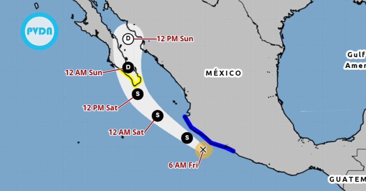
Tropical Storm Ivo forecasted to strengthen into a hurricane by Friday while coastal areas face rain and dangerous surf . . .
X
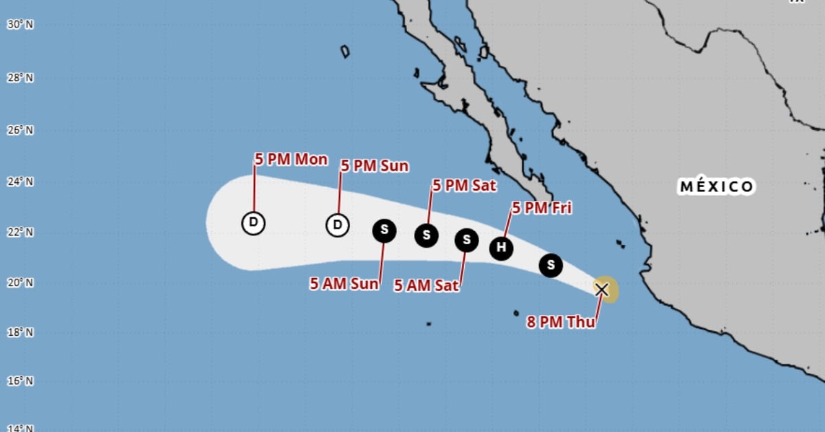
Tropical Storm Ivo forecasted to strengthen into a hurricane by Friday while coastal areas face rain and dangerous surf . . .