Two storms off the Pacific Coast of Mexico have an 80% chance of development and bringing heavy rains to Puerto Vallarta this weekend with chances of flooding and landslides. Attention should be given to the development of these two storms over the next 72 hours.
Puerto Vallarta, Jalisco – Important and beneficial accumulated rainfall was accompanied by Hurricane Kay last week from Guerrero to Baja California, reaching 236 mm in San Bartolo, Baja California Sur. However, negative effects such as floods and dangerous currents caused damage, and several deaths were also left behind by Hurricane Kay.
We are reaching the middle of September, being the most active month for hurricane season, and the weather is behaving according to the forecast for 2022. We still expect more precipitation in the second half of this month due to unstable systems such as troughs, waves, and cyclones, as well as its possible interaction with the first cold fronts of the winter season. Now, within the next 3 to 7 days, there is a probability that some tropical depression or tropical storm will generate significant rains in the country.
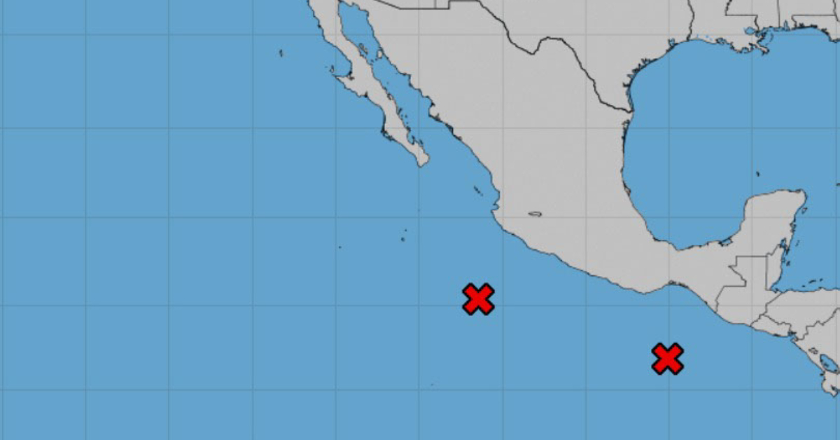
Since September 9, the National Hurricane Center has been monitoring a disturbance zone that was located south of Oaxaca, currently labeled 95-E; later this week another disturbance developed southwest of Jalisco, being 94-E. According to the models, these meteorological systems would be evolving into a tropical cyclone with a 50-80% probability; the names to use would be Lester and Madeline.
The uncertainty in its possible behavior and trajectory has been present, but currently, the following weather forecast could be expected: 95E could first become a depression or tropical storm this Friday the 16th or Saturday the 17th when it would be near the coasts of Oaxaca and Guerrero, with a probability of landfall in Guerrero, and also affecting Michoacán, Colima and Jalisco over the weekend where the rains can have accumulated 70-150 mm with localized levels of 200-350 mm.
The cyclone could quickly dissipate, but its remnants would combine with disturbance 94-E to the southwest of Jalisco, giving it strength, and could also become a tropical storm next Sunday or Monday. This, the distance it could have from the western coasts of the territory is still uncertain, but at least, the models do show more abundant rainfall in the area. For all this, the population from Oaxaca to Jalisco must be very aware of the updates in the coming days and prepare for a possible direct impact.
The described systems would also be combined with an extensive trough over the Vertiente del Golfo, which would cause abundant rainfall over Campeche, Tabasco, Chiapas, Veracruz, Oaxaca, Puebla, Tamaulipas, State of Mexico, Morelos, Guerrero, Mexico City, Michoacán, Colima, Jalisco and Nayarit with daily accumulations of 20-50 mm and specific ones of 70-150 mm between Thursday the 15th and Monday the 19th .
The probability of floods, dangerous currents, flooding/overflowing of rivers or streams, and landslides on slopes will be very high, and it is important that people in vulnerable areas heed indications from the authorities.
Other states such as Sonora, Chihuahua, Coahuila, Nuevo León, Sinaloa, Durango, Zacatecas, San Luis Potosí, Aguascalientes, Guanajuato, Querétaro, Hidalgo and Tlaxcala would have more scattered rainfall in this period, estimating daily accumulations of 5 to 20 mm and specific ones of 30-50mm.
Two storms off the Pacific Coast of Mexico have an 80% chance of development and bringing heavy rains to Puerto Vallarta this weekend . . .


