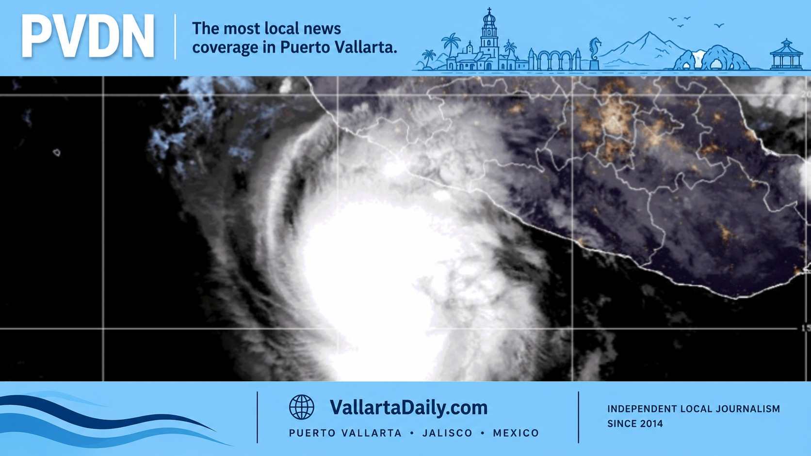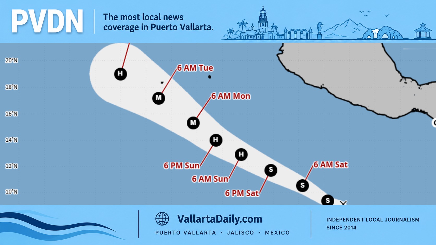
Puerto Vallarta, Jalisco, July 24, 2026 – Tropical Depression Seven-E formed far south of Mexico on Friday and could intensify into a major hurricane by early next week, but its projected path keeps the system well away from Puerto Vallarta and the Mexican coast.
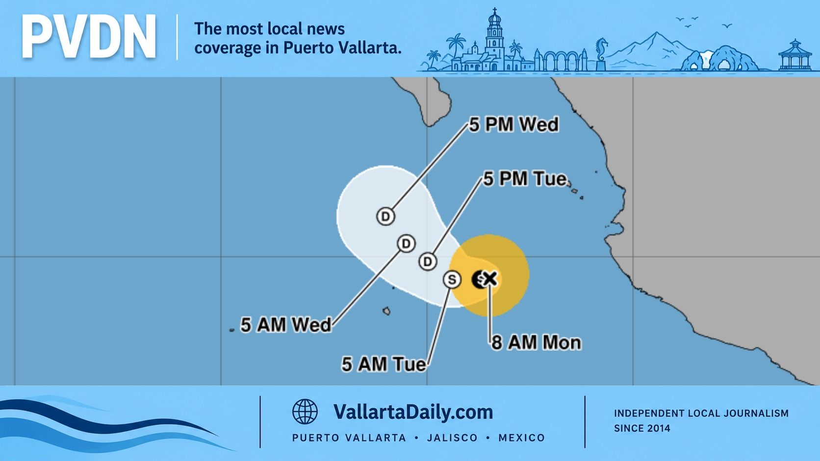
The depression was centered about 975 kilometers south of Zihuatanejo at 9 a.m. Central Time, moving west-northwest at 19 km/h. Maximum sustained winds were near 55 km/h.
The system was approximately 1,390 kilometers south-southeast of Puerto Vallarta based on its reported coordinates.
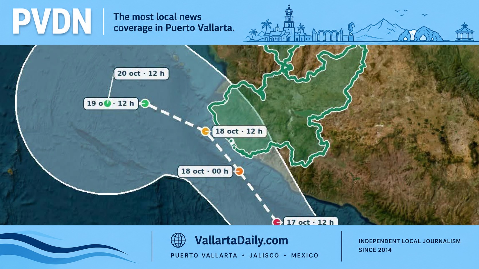
No coastal watches or warnings were in effect, and the National Hurricane Center’s first public advisory listed no hazards affecting land. The west-northwest motion is expected to continue during the next several days, taking the cyclone farther into the open Pacific.
Seven-E is expected to reach tropical storm strength Friday afternoon or evening. Once its sustained winds reach at least 63 km/h, it will receive the name Genevieve, the next name on the Eastern Pacific list.
The more notable part of the initial outlook is the expected pace of strengthening. Warm ocean water near 30°C, weak upper-level winds, and favorable atmospheric conditions could allow the system to intensify quickly beginning this weekend.
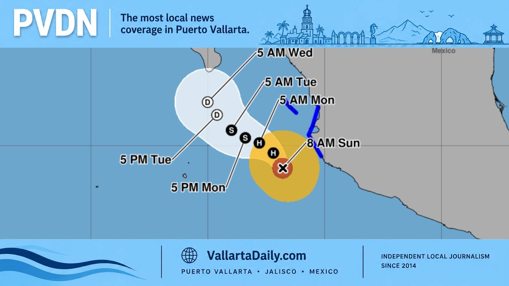
The NHC intensity forecast shows the cyclone reaching hurricane strength Sunday and potentially becoming a major hurricane early Monday. Sustained winds could reach 185 km/h, equivalent to Category 3 strength, while the center remains hundreds of kilometers southwest of Mexico.
The forecast is more aggressive than a typical first advisory. NHC guidance placed the probability of a 120 km/h increase in wind speed within 72 hours at 76 percent. More than 60 percent of the agency’s Google DeepMind ensemble projections also showed the system reaching major hurricane strength.
Those intensity projections can change substantially during a newly formed cyclone’s first several advisories. Satellite data were still being used Friday morning to refine the depression’s center and initial wind estimate.
The track guidance was more consistent. Forecast models broadly agreed on movement toward the west-northwest or northwest under a ridge positioned north of the cyclone. By Tuesday morning, the projected center would be near 19 degrees north and 118 degrees west, well southwest of Baja California.
Puerto Vallarta’s rain and elevated ocean conditions Friday should not be interpreted as evidence that Seven-E is affecting the bay. The National Meteorological Service forecast attributed western Jalisco’s expected rain to the Mexican monsoon, atmospheric troughs and Pacific moisture.
The agency predicted 50 to 75 millimeters of rain in parts of western and southeastern Jalisco, along with thunderstorms, possible hail and localized flooding. Swells of 1.5 to 2.5 meters were also expected along the Jalisco coast. Those conditions are part of the broader regional weather pattern rather than a direct impact from the newly formed depression.
Seven-E follows Hurricane Fausto, which also remained far from Mexico while strengthening over open water. Vallarta Daily reported earlier this week that Fausto posed no threat to Puerto Vallarta.
The new cyclone’s development continues an active stretch in the Eastern Pacific. Vallarta Daily’s 2026 Pacific hurricane season outlook examines the season’s broader risks and the conditions that could influence storms later in the year.