Hurricane Trudy rapidly intensifies; heavy rain forecast for Jalisco
Updated: October 15, 2026, at 9 a.m. CST, Puerto Vallarta time
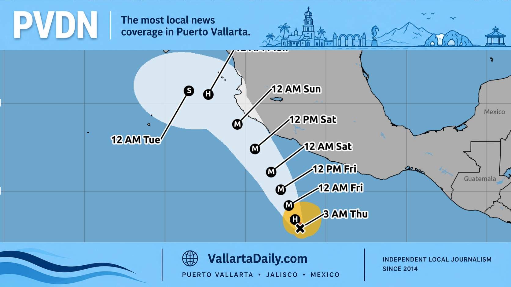
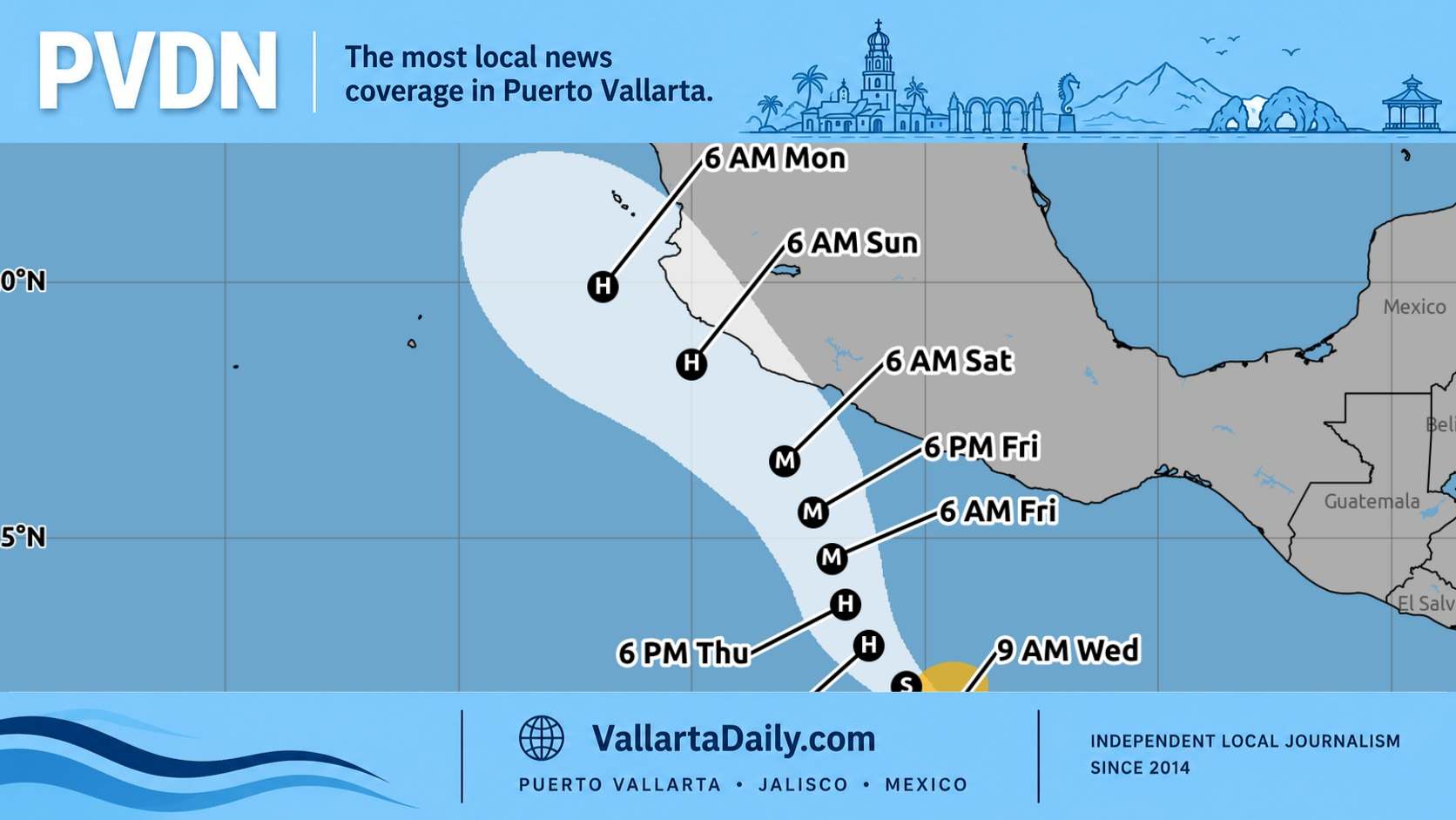
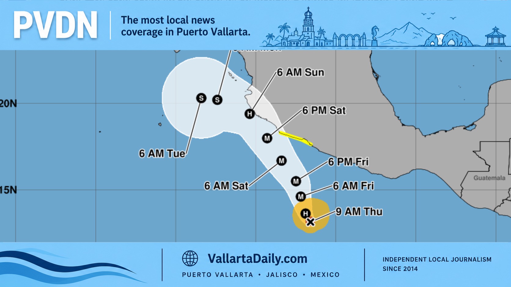
Hurricane Trudy strengthened to 90 mph Thursday morning and is forecast to become a major hurricane by Friday as it approaches southwestern and west-central Mexico this weekend, the National Hurricane Center says.
Forecasters expect 4 to 8 inches of rain across Colima and Jalisco through the weekend, with isolated totals near 12 inches—about 100 to 200 millimeters —and isolated amounts near 300 millimeters. The rainfall could cause life-threatening flooding and mudslides, particularly in mountainous areas.
At 9 a.m., Trudy was about 715 kilometers south-southeast of Manzanillo, moving north-northwest at 9 km/h. That movement is expected to continue for about another day before turning northwest this weekend.
Mexico issued a tropical storm watch from Punta San Telmo southward to Zihuatanejo, where tropical storm conditions could begin early Saturday. Additional coastal watches will likely be needed later Thursday.
Hurricane-force winds extend up to 25 miles from the center, while tropical-storm-force winds reach outward up to 105 miles.
What the forecast means for Puerto Vallarta
Puerto Vallarta is outside the tropical storm watch area listed in the 9 a.m. advisory. However, the National Hurricane Center urged interests elsewhere in southwestern and west-central Mexico to monitor Trudy’s progress.
For Puerto Vallarta, Jalisco’s inclusion in the heavy-rain outlook makes rainfall and flooding risks a key concern to monitor. The projected totals cover a broad area across two states; they are not a specific rainfall forecast for Puerto Vallarta.
This advisory does not establish a Puerto Vallarta landfall or specify when damaging winds might reach the city. Local wind impacts will depend on Trudy’s eventual track, strength, and size as it approaches the coast.
Trudy is also expected to generate dangerous surf and rip currents along portions of southwestern Mexico’s coast beginning over the next day and continuing through the weekend. Residents and visitors should follow subsequent forecasts and local Civil Protection guidance as coastal conditions develop.
The next intermediate advisory is scheduled for noon CST, followed by a complete update at 3 p.m. Thursday.
Latest live updates
PVDN has begun tracking Hurricane Trudy and will update readers with important information as the storm develops and its track becomes clearer.