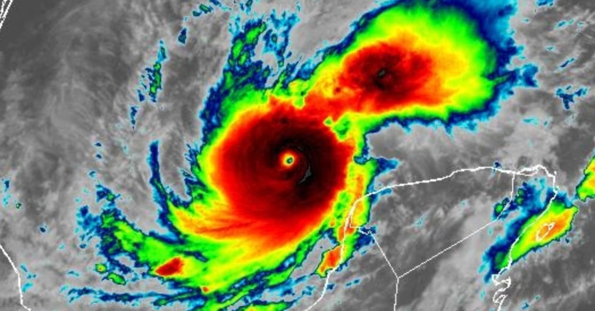
As tropical cyclone season reaches its peak, Hurricane Milton has intensified rapidly, now classified as a Category 5 storm. The hurricane, located in the Gulf of Mexico, is affecting the Yucatán Peninsula and the southern United States, bringing heightened alerts across the region. According to the latest reports from the National Meteorological Service (SMN) and the National Hurricane Center (NHC), Milton is situated approximately 165 kilometers northwest of Celestún and 200 kilometers west-northwest of Progreso in Yucatán.