The Government of Jalisco continues to work in coordination with federal and municipal authorities, applying the necessary measures in order to safeguard the well-being of the population on the Jalisco Coast due to the passage of tropical storm “Roslyn”.
The Secretary General of the Government, Enrique Ibarra Pedroza, informed and requested the companies in charge of tourist activities on the Coast to prioritize the well-being and life of people and avoid promoting and carrying out outdoor ecotourism activities on the beach and in mountainous areas such as the use of ATVs and razers during this weekend.
Likewise, it was requested that they be kept informed through the internal Civil Protection Units of the hotel complexes and the corresponding authorities.
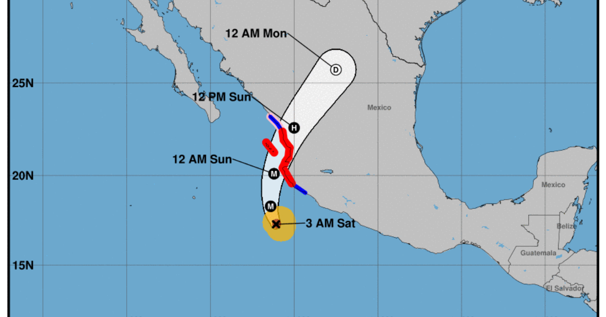
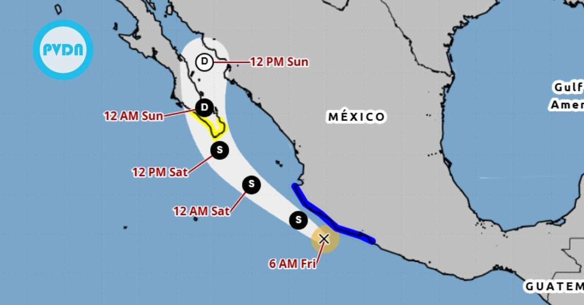
Roslyn is moving toward the north-northwest near 8 mph (13 km/h). A turn toward the north is expected later today and tonight, followed by a faster motion toward the north-northeast on Sunday. On the forecast track, the center of Roslyn will move parallel to the southwestern coast of Mexico through midday today, then approach the coast of west-central Mexico, likely making landfall along the coast of the Mexican state of Nayarit Sunday morning.
Rosyln becomes category 4 hurricane
Maximum sustained winds have increased to near 130 mph (215 km/h) with higher gusts. Roslyn is a category 4 hurricane on the Saffir-Simpson Hurricane Wind Scale. Additional strengthening is forecast today. Although some weakening is possible beginning tonight, Roslyn is expected to still be near or at major hurricane strength when it makes landfall on Sunday.
Hurricane-force winds extend outward up to 30 miles (45 km) from the center and tropical-storm-force winds extend outward up to 80 miles (130 km). An Air Force Reserve Hurricane Hunter aircraft is currently en route to investigate Roslyn.
HAZARDS AFFECTING LAND
WIND: Hurricane conditions are expected to reach the coast within the hurricane warning area by tonight and early Sunday. Winds are expected to first reach tropical storm strength by this afternoon, making outside preparations difficult or dangerous. Preparations to protect life and property should be rushed to completion.
Hurricane conditions are possible within the hurricane watch area on Sunday.
Tropical storm conditions are expected within the tropical storm warning area south of Playa Perula today or tonight, and within the warning area north of El Roblito on Sunday.
RAINFALL: Roslyn is expected to produce the following rainfall totals across coastal areas of southwestern and west-central Mexico:
Michoacán and the lower coast of Colima: 1 to 3 inches
Jalisco: 4 to 8 inches with maximum amounts of 10 inches along the northern coast.
Upper coast of Colima, western Nayarit including Islas Marias and southeastern Sinaloa: 4 to 6 inches with maximum amounts of 8 inches
Southern Durango into western Zacatecas: 1 to 3 inches with maximum amounts of 5 inches.
This rainfall could lead to flash flooding and landslides in areas of rugged terrain.
STORM SURGE: A dangerous storm surge is expected to produce significant coastal flooding near and to the east of where the center makes landfall. Near the coast, the surge will be accompanied by large and destructive waves.
SURF: Swells generated by Roslyn are affecting portions of the coast of southwestern Mexico and will spread northward to the coast of west-central Mexico and the southern portion of the Baja California peninsula through the weekend. These swells are likely to cause life-threatening surf and rip current conditions.
The Government of Jalisco continues to work in coordination with federal and municipal authorities, applying the necessary measures in order to safeguard the well . . .