Puerto Vallarta, Mexico – With the first official storms less than a month away, federal forecasters and climate-policy advocates are urging coastal communities to prepare for a busier-than-average 2025 hurricane season.
When does the season start?
According to the National Meteorological Service (SMN), the season opens May 15 in the Pacific basin and June 1 in the Atlantic, ending for both regions on November 30. These dates are anchored in decades of historical storm data compiled by SMN, an agency of the National Water Commission (Conagua).
Why the heightened concern?
Mexico’s position between two warm oceans makes it one of the most hurricane-exposed countries on Earth. Climate change is magnifying that risk, says Pablo Ramírez, coordinator of the Energy and Climate Change Program at Greenpeace Mexico.
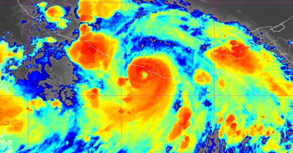
“Warmer sea-surface temperatures and shifting currents are super-charging cyclones,” Ramírez told reporters, pointing to Hurricane Otis as a “cautionary tale.” Otis exploded from a tropical storm into a Category 5 monster in just 12 hours last October, devastating Acapulco and becoming 2023’s costliest weather disaster worldwide.
2025 outlook: a ‘neutral’ year but still above normal
Forecasters classify the current El Niño–Southern Oscillation (ENSO) phase as neutral—neither El Niño’s hotter, drier pattern nor La Niña’s cooler, wetter one dominates the tropical Pacific. Even so, the ECMWF long-range model projects up to 16 named systems this year, seven of them hurricanes—about two more storms and one more hurricane than the long-term average. All forecasts are subject to mid-season updates as ocean temperatures evolve.
States in the crosshairs
| Pacific Basin | Atlantic Basin |
|---|---|
| Baja California Sur | Quintana Roo |
| Sinaloa | Yucatán |
| Jalisco | Veracruz |
| Colima | Tamaulipas |
| Michoacán | Campeche |
| Guerrero | — |
| Oaxaca | — |
SMN and the National Civil Protection Coordination (CNPC) identify these states as the most frequently struck by tropical cyclones. Ramírez notes that vulnerability has “grown sharply,” not just from stronger storms but from poverty, coastal erosion, and the patchy adoption of contingency plans.
Mexico does maintain a National Risk Atlas, yet few states have their own detailed climate-risk maps. Tabasco—home to the country’s first community displaced by climate change—drafted a climate plan that “was never published,” Ramírez said. “Updating those instruments is urgent for an effective climate policy.”
How cyclones are classified
- Tropical Depression – winds < 63 km/h (39 mph)
- Tropical Storm – winds 63–118 km/h (39–73 mph)
- Hurricane – winds ≥ 119 km/h (≥ 74 mph)
Once a system reaches hurricane strength, the Saffir–Simpson scale grades it from Category 1 (119–153 km/h) to Category 5 (≥ 252 km/h). Otis reached the upper threshold last year, underscoring how rapidly conditions can deteriorate when seas are anomalously warm.
What happens next?
- SMN will begin issuing daily outlooks on May 15 for the Pacific and June 1 for the Atlantic.
- Civil Protection authorities in each state are expected to update evacuation routes and shelter lists by early May.
- Residents in at-risk areas should prepare emergency kits, review insurance policies, and sign up for local alert systems.
“Neutral ENSO does not mean neutral risk,” Ramírez warned. “As long as the oceans keep heating, every coastal community should act as though the next Otis could form on their doorstep.”
With sea-surface temperatures already trending above average in parts of the eastern Pacific and Gulf of Mexico, Mexico’s 2025 hurricane season may once again test the nation’s readiness—and resolve—to confront a changing climate.
Puerto Vallarta, Mexico - With the first official storms less than a month away, federal forecasters and climate-policy advocates are urging coastal communities to . . .
")


