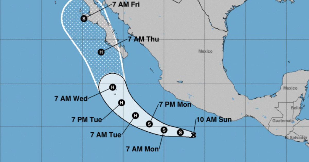
At 1000 AM CDT (1500 UTC), the center of Tropical Depression Twelve-E was located near latitude 14.0 North, longitude 101.4 West.
The depression is moving toward the west near 10 mph (17 km/h) and a west to west-northwest motion is expected during the next couple of days, followed by a turn to the north.
The depression is expected to remain south of southwestern Mexico during the next couple of days.
Maximum sustained winds are near 35 mph (55 km/h) with higher gusts. Strengthening is forecast, and the . . .