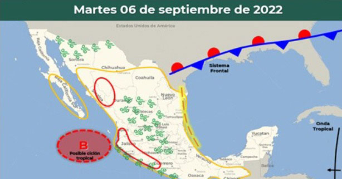
During the 5-day forecast period, the low-pressure system in the Pacific is expected to become a tropical storm within the next 48- hours and will move parallel to the coasts of Guerrero, Michoacán, Colima, and Jalisco, when a warning may need to be issued for Puerto Vallarta if the trajectory and current rate of strengthening continue over the next three days.
The storm will remain close to the Pacific coastline moving towards Baja California Sur, on its way it will maintain the storm of intense rains at torrential points in areas of Oaxaca, Guerrero . . .