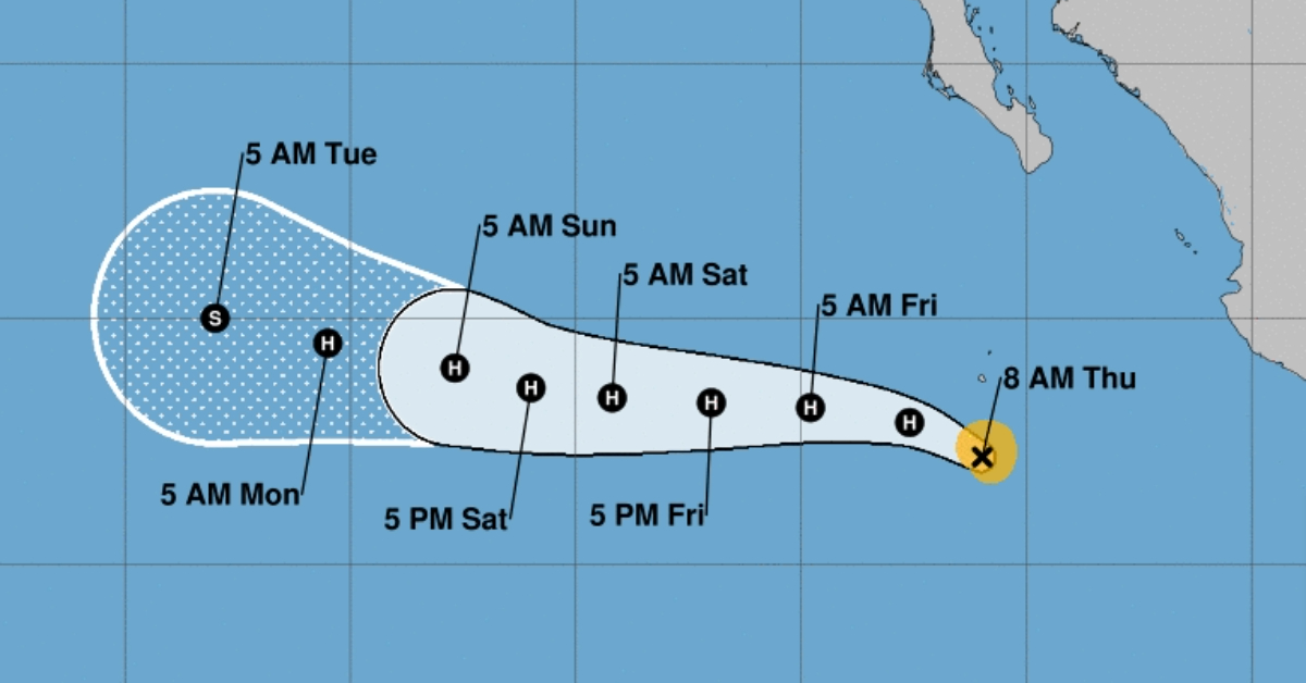
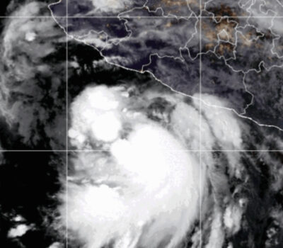
Puerto Vallarta, Mexico – Tropical Storm Carlotta has been a focus of meteorological observation as it undergoes significant changes in its intensity and trajectory. Over the past 12 to 18 hours, Carlotta has intensified, though it is currently experiencing a brief pause as its inner core becomes more established. Despite this temporary pause, the storm remains robust, as evidenced by satellite imagery that shows numerous curved bands around a developing central dense overcast (CDO).
As of the latest advisory, Carlotta maintains an intensity of 50 knots, based on a blend of subjective Dvorak intensity estimates. This measurement places it in the middle range of objective intensity guidance, suggesting a healthy storm structure. The central dense overcast is becoming more defined, indicating a well-organized system, although a fully developed eye has yet to appear in visible imagery.
Carlotta is currently moving west-northwestward at a speed of 10 knots, following a trajectory of 295 degrees. This motion is influenced by a significant deep-layer ridge located over the southwestern United States. As the ridge strengthens, Carlotta is expected to shift more westward over the coming days. However, by day three and beyond, the storm will encounter a weakness to the north, likely causing a slowdown in its forward motion and a subtle shift toward the pole.
The latest track guidance suggests a slightly more northern and faster path compared to previous forecasts. Consequently, the National Hurricane Center (NHC) has adjusted its track forecast in line with this guidance, balancing it between the prior forecast and reliable consensus models such as TVCE and HCCA.
Environmental conditions remain conducive to further intensification of Carlotta. The sea-surface temperatures (SSTs) are warm, ranging between 28 to 29 degrees Celsius, and the shear levels are low to moderate, between 10 to 15 knots from the northwest. The future rate of intensification will largely depend on the evolution of Carlotta’s inner core, although recent microwave imagery to assess the storm’s current structure is unavailable.
The SHIPS rapid intensification index has decreased slightly since last night, potentially reflecting the temporary halt in intensification. Nonetheless, recent GOES-18 satellite images indicate that the CDO is becoming better established, which may lead to further strengthening.
The NHC’s intensity forecast maintains the same rate of intensification over the next 24 hours as the previous cycle, aligning more closely with regional hurricane models HAFS-A/B than with the lower consensus models influenced by the SHIPS and LGEM guidance. However, a gradual weakening is anticipated between days three to five, as SSTs along the forecast track drop below 26 degrees Celsius.
As Carlotta continues to evolve, monitoring its path and intensity changes remains crucial. Coastal regions along the projected path should stay informed about potential impacts and be prepared for any necessary precautions. The gradual weakening expected in the coming days suggests that while Carlotta may pose less of a threat over time, its current status warrants attention and readiness.
Puerto Vallarta, Mexico - Tropical Storm Carlotta has been a focus of meteorological observation as it undergoes significant changes in its intensity and trajectory. Over the past 12 to 18 hours, Carlotta has intensified, though it is currently experiencing a brief pause as its inner core becomes more established. Despite this temporary pause, the storm remains robust, as evidenced by satellite imagery that shows numerous curved bands around a developing central dense overcast (CDO).

