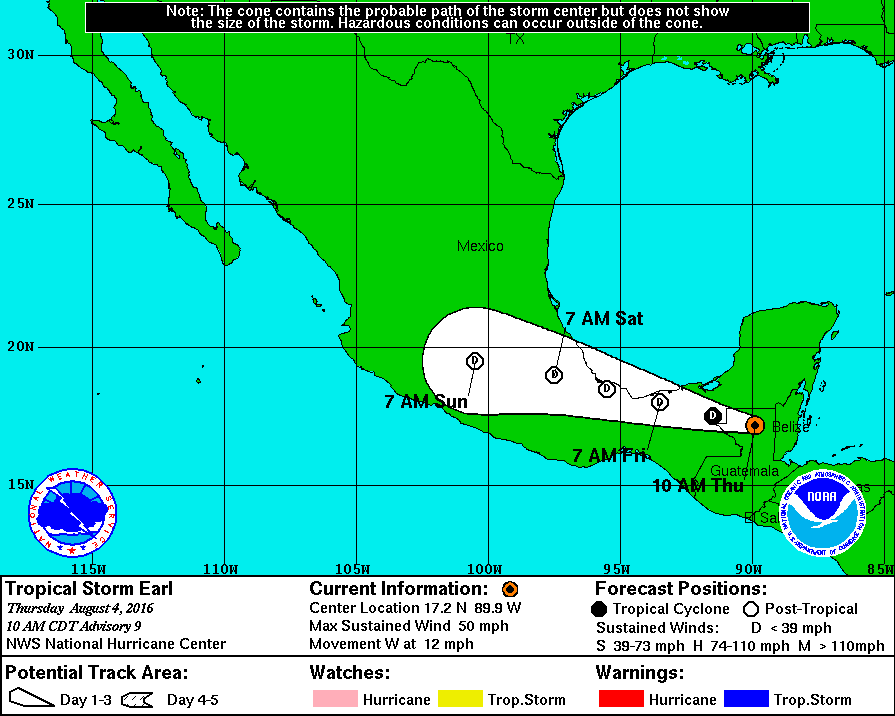
The center of Tropical Storm Earl was located well inland near latitude 17.2 North, longitude 89.9 West. Earl is moving toward the west near 12 mph (19 km/h), and this general motion is expected to continue during the next couple of days. On the forecast track, Earl will continue to move across northern Guatemala and southeastern Mexico tonight and Friday.
Maximum sustained winds have decreased to near 50 mph (85 km/h) with higher gusts. Additional weakening is expected as the center moves over high terrain, and Earl is forecast to weaken to a tropical depression by tonight.
Tropical-storm-force winds extend outward up to 60 miles (95 km) to the east of the center.
The estimated minimum central pressure is 990 mb (29.24 inches).
HAZARDS AFFECTING LAND
———————-
WIND: Tropical storm conditions within a small area near the center should spread westward over northern Guatemala and southeastern Mexico today.
RAINFALL: Earl is expected to produce total rainfall accumulations of 8 to 12 inches over portions of Belize, Guatemala, and the Mexican states of Campeche, Chiapas, Quintana Roo, Tabasco and Veracruz through Friday morning. Isolated maximum amounts of 18 inches are possible in Belize, northern Guatemala and the central part of the Mexican state of Chiapas. These rains could result in life-threatening flash floods and mudslides.
The center of Tropical Storm Earl was located well inland near latitude 17.2 North, longitude 89.9 West. Earl is moving toward the west . . .
")


