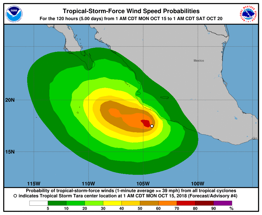
At 700 AM CDT (1200 UTC), the center of Tropical Storm Tara was located near latitude 17.6 North, longitude 104.3 West. Tara is moving toward the west-northwest at near 2 mph (4 km/h), and this general motion is expected to continue for the next day or so. A slightly faster westward motion is forecast to begin after mid-week. On the forecast track, the center of Tara is expected to remain near or just offshore of the southwestern coast of Mexico during the next couple of days.
Maximum sustained winds are near 40 mph (65 km/h) with higher gusts. Gradual strengthening is forecast during the next couple of days.
Tropical-storm-force winds extend outward up to 35 miles (55 km) from the center.
The estimated minimum central pressure is 1003 mb (29.62 inches).
HAZARDS AFFECTING LAND
———————-
RAINFALL: Tara is expected to produce total rain accumulations of 3 to 5 inches with isolated maximum amounts of 8 inches through Tuesday along the coastal sections of the Mexican states of Michoacan, Colima, and Jalisco. These rains may produce life-threatening flash floods.
WIND: Tropical storm conditions are possible within the watch area by tonight or Tuesday.