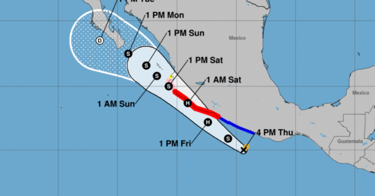
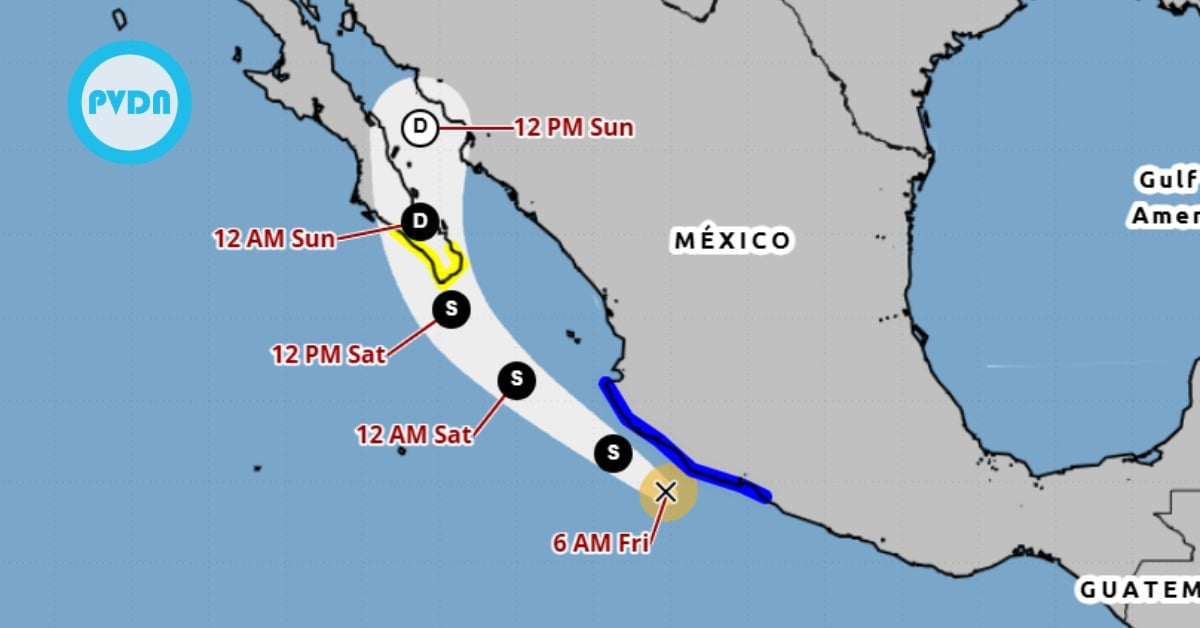
PUERTO VALLARTA (PVDN) – The Mexican Government has issued a Hurricane Warning from Zihuatanejo to Playa Perula, as Tropical Storm Beatriz intensifies off the west-central coast. A Tropical Storm Watch has also been put in place from north of Cabo Corrientes to Punta Mita, including Puerto Vallarta, indicating the growing potential of adverse weather conditions in these areas.
UPDATE: PUERTO VALLARTA IS NOW UNDER A HURRICANE WATCH WARNING
According to the official advisories, a Hurricane Warning is in effect from Zihuatanejo to Playa Perula, and a Hurricane Watch north of Playa Perula to Cabo Corrientes. A Tropical Storm Warning has been announced south of Zihuatanejo to Punta Maldonado, while a Tropical Storm Watch is in place north of Cabo Corrientes to Punta Mita.
The Hurricane Warning indicates that conditions for a hurricane are expected within the warning area and advises residents to complete preparations to protect life and property. Such warnings are typically issued 36 hours ahead of the anticipated first occurrence of tropical-storm-force winds that make outdoor preparations difficult or dangerous.
The Hurricane Watch suggests hurricane conditions are possible within the watch area within 48 hours. Similarly, a Tropical Storm Warning means that tropical storm conditions are expected within the warning area within 36 hours, while a Tropical Storm Watch indicates possible tropical storm conditions within the watch area, generally within 48 hours.
Residents and interests along the west-central coast of Mexico and in the southern portion of the Baja California peninsula are advised to monitor the progress of this system closely. Additional warnings and watches may be required tonight or on Friday, as the situation evolves.
As of 4:00 PM CDT (2100 UTC), the center of Tropical Storm Beatriz was located near latitude 15.0 North, longitude 99.4 West, moving west-northwest at approximately 12 mph (19 km/h). Beatriz is expected to shift towards a northwestward direction tonight and slow down over the weekend. Based on the forecast, the center of Beatriz is anticipated to move very near or along the coast of southwestern Mexico in the next couple of days.
Tropical Storm Beatriz, currently having maximum sustained winds near 40 mph (65 km/h) with higher gusts, is forecasted to strengthen rapidly and likely to become a hurricane on Friday. Tropical-storm-force winds currently extend up to 45 miles (75 km) from the storm’s center, with an estimated minimum central pressure of 1004 mb (29.65 inches).
Beatriz is expected to bring heavy rainfall, with storm totals of 3 to 5 inches and maximum amounts of 7 inches, from Oaxaca west to Jalisco through Sunday morning, potentially leading to localized flash flooding. Significant coastal flooding is anticipated due to a dangerous storm surge in areas of onshore winds, accompanied by large and destructive waves.
Swells generated by Beatriz are forecasted to build and spread northward along the southwestern coast of Mexico in the next couple of days. These swells could cause life-threatening surf and rip current conditions. Residents are urged to consult local weather office products for more specific information on their area.
PUERTO VALLARTA (PVDN) - The Mexican Government has issued a Hurricane Warning from Zihuatanejo to Playa Perula, as Tropical Storm Beatriz intensifies off the west . . .