Update: The government of Mexico has discontinued the Tropical Storm Warning for western mainland Mexico.
*** Previous Story ***
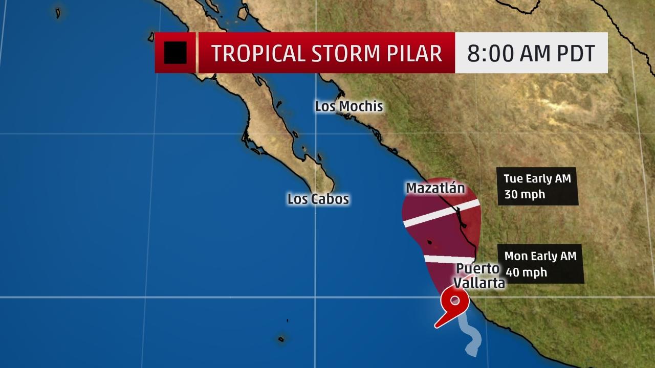
Tropical Storm Pilar formed late Saturday night just off the southwestern coast of Mexico and while not long-lasting, poses a danger of heavy rainfall, flash flooding, and mudslides.
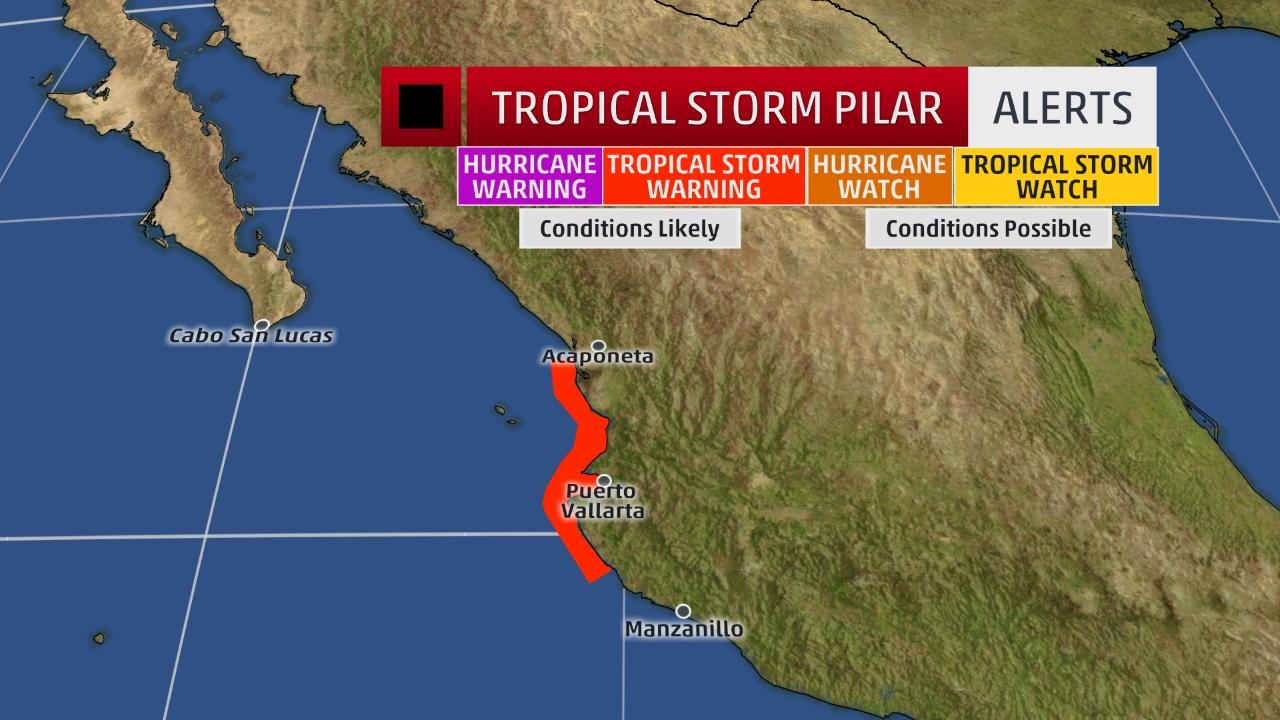
Tropical storm warnings have been issued for the southwestern Mexican coast from Playa Perula to El Roblito including the Islas Marias, including the city of Puerto Vallarta. According to the National Hurricane Center, a wind gust to 78 mph was measured at an automated station in Jalisco state (Chamelacuixmala) at an elevation of 276 feet above sea level.
Here’s the latest from the National Hurricane Center:
- The center of Tropical Storm Pilar is located less than 40 miles from Cabo Corientes, Mexico and is tracking north-northwest at 5 to 10 mph.
- Pilar is forecast to roughly parallel the southwest Mexican coast the next few days. If the center moves inland sooner, it will weaken sooner.
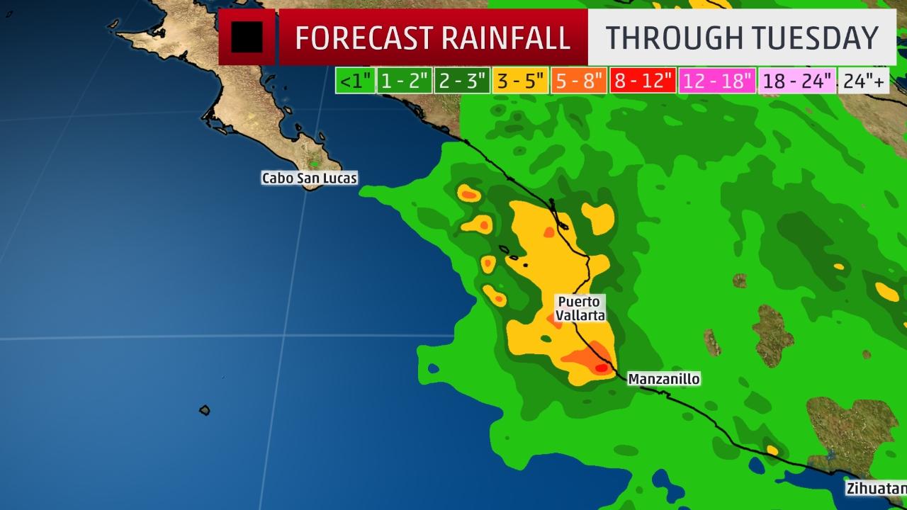
- Heavy rain is expected to be the main threat from this system.
Flash flooding and mudslides are the greatest concern with Pilar.
Three to seven inches of rain are expected in portions of southwestern Mexico, and isolated amounts up to 15 inches possible in western parts of the Mexican states of Michoacan, Colima, Jalisco, Nayarit and southern Sinaloa.
Some weakening is forecast during the next 48 hours and Pilar is expected to become a remnant low by Tuesday.
Update: The government of Mexico has discontinued the Tropical Storm Warning for western mainland Mexico.
*** Previous Story ***
Tropical Storm Pilar formed late Saturday . . .
")


