PUERTO VALLARTA (PVDN) – The second storm of the Pacific Hurricane Season has already caused watches and warnings to be posted along Mexico’s West Coast before it even reaches tropical storm strength.
NEW: Puerto Vallarta Under a Hurricane Watch
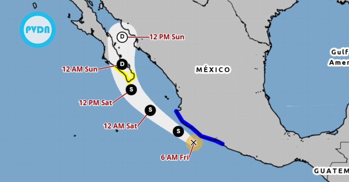
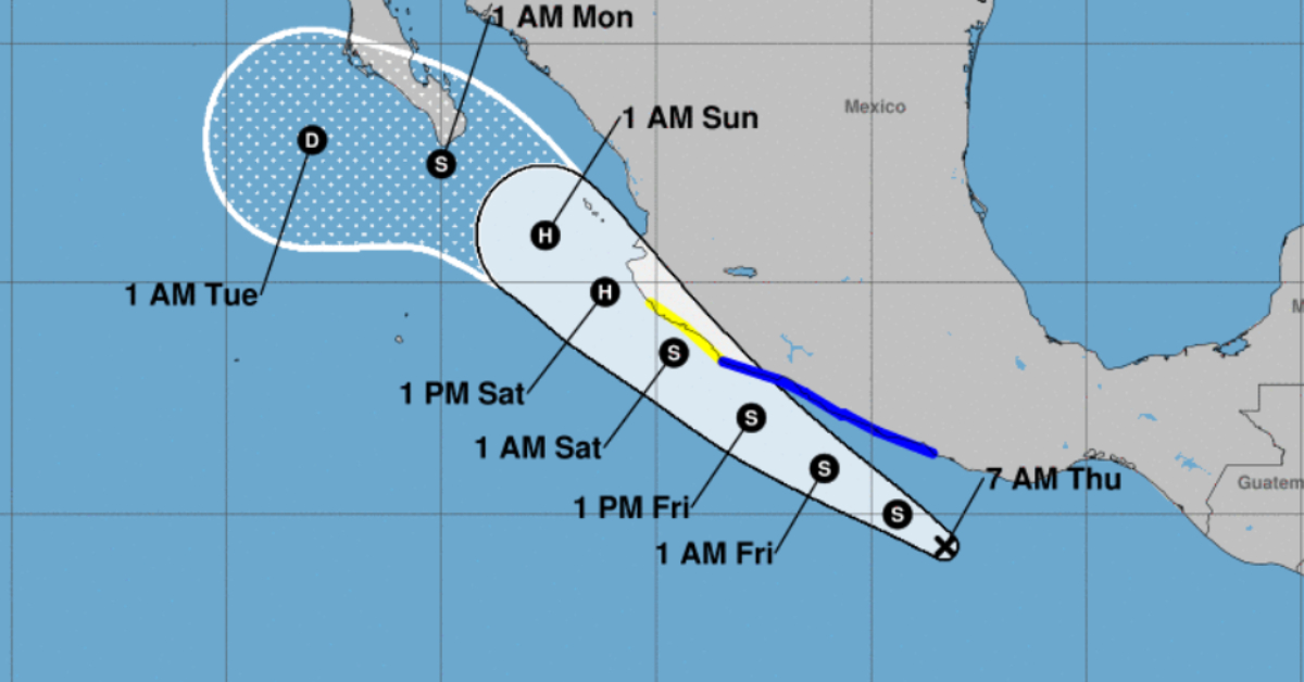
The storm is expected to become Tropical Storm Beatriz today and strengthen into a hurricane within the next two days as it brushes the coast of Mexico and approaches Puerto Vallarta on its current forecast. Puerto Vallarta could be under a storm advisory by the weekend.
A Tropical Storm Warning has been issued from Punta Maldonado to Punta San Telmo in Mexico, with experts predicting that tropical storm conditions are likely to occur within the next 36 hours. Meanwhile, a Tropical Storm Watch has been activated to the north of Punta San Telmo up to Playa Perula, where tropical storm conditions may become apparent within 48 hours.
These developments warrant the attention of communities along the southwestern coast of Mexico and the southern region of the Baja California peninsula, as they should closely monitor this system’s progress. Further warnings and watches may be announced for these regions later today.
Tropical Depression Two-E’s center was located near latitude 14.3 North, longitude 98.3 West as of 7:00 AM CDT (12:00 UTC). Moving towards the northwest at a speed of 14 mph (22 km/h), the depression’s trajectory is expected to maintain this general direction for the next few days, coming closer to the southwestern coast of Mexico.

The depression currently presents maximum sustained winds near 35 mph (55 km/h), with gusts reaching higher speeds. However, forecasters anticipate a strengthening of the system, predicting it will escalate to a tropical storm later today. The estimated minimum central pressure of Tropical Depression Two-E is 1006 mb (29.71 inches).
As the storm develops, several hazards are likely to affect the mainland. Tropical storm conditions are expected to commence in the warning area by later today, lasting through to Friday, with possible onset in the watch area by late Friday through Friday night.
Rainfall projections anticipate a total of 3 to 5 inches from Oaxaca west to Jalisco in southern Mexico through Saturday, with a maximum amount of 7 inches in certain areas. This substantial rainfall is likely to result in localized flash flooding.
Moreover, the depression is set to generate swells that will increase and spread northward along the southwestern coast over the coming days. These conditions pose a severe risk for life-threatening surf and rip currents. The public is advised to consult products from local weather offices for further details.
PUERTO VALLARTA (PVDN) - The second storm of the Pacific Hurricane Season has already caused watches and warnings to be posted along Mexico's West . . .