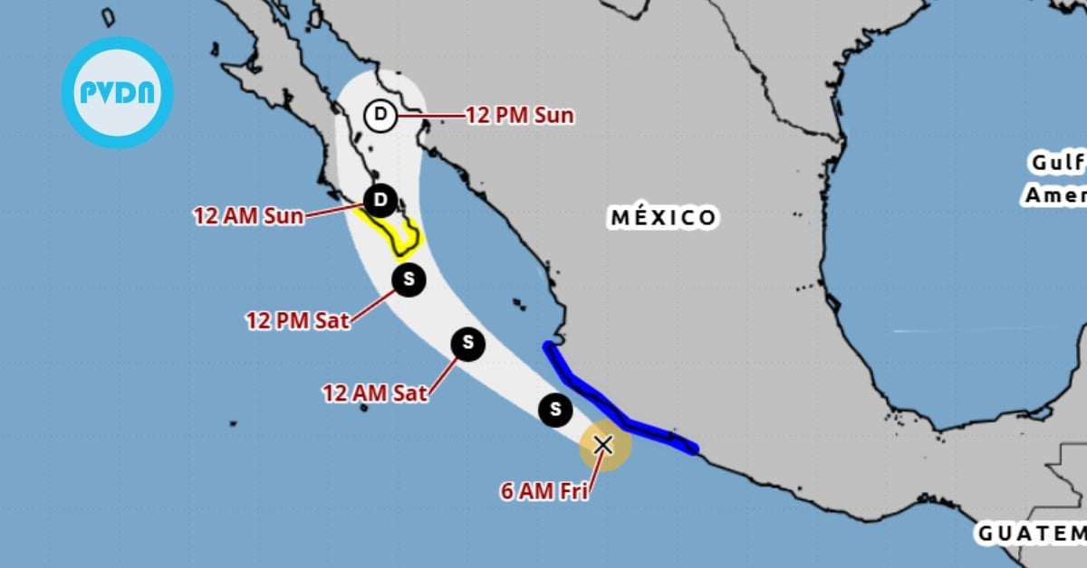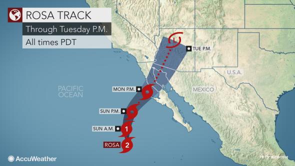
Rosa is expected to batter far northwestern Mexico with gusty winds and flooding rainfall on the first day of October.
Among the communities in the path of Rosa is Mexicali, the region's capital, which normally receives about 7 mm (0.3 of an inch) of rainfall during the entire month of October. The city could be inundated with as much as three times this amount in just one day as Rosa impacts the area early next week.
Rosa, currently a Category 2 hurricane churning out in the eastern Pacific, is expected to turn northeastward and make . . .