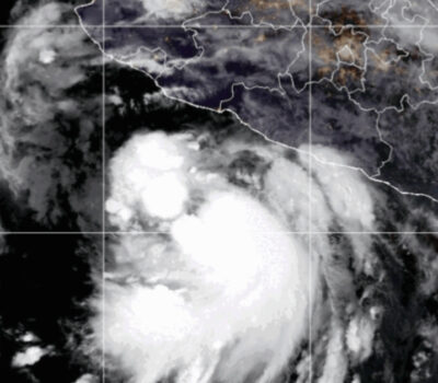
Hurricane Carlos formed Saturday over the Pacific Ocean south of Acapulco, Mexico, prompting a hurricane watch to be issued for a swath of that country’s southwest coastline, U.S.-based forecasters said.
The U.S. National Hurricane Center said Carlos’ eye was centered at 11 a.m. EDT Saturday about 140 miles (225 kilometers) south of the tourist resort of Acapulco and that the storm had top sustained winds of 75 mph (120 kph). Forecasters said Carlos, a tropical storm only hours earlier, had gained strength overnight and was moving toward the northwest at 2 mph (4 kph).
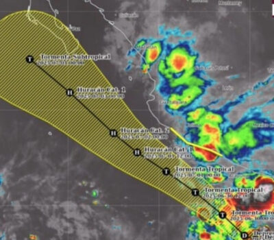
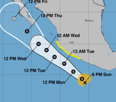
Mexico’s government has issued a hurricane watch from Lazaro Cardenas to Punta San Telma along Mexico’s southwest mainland coast, meaning hurricane conditions were possible within that area within 48 hours. A tropical storm warning also was in effect from Tecpan de Galeana to Lazaro Cardenas, while a tropical storm watch was in effect for areas east of Tecpan de Galeana to Acapulco.
Puerto Vallarta could see hurricane warnings issued as early as Sunday as the storm moves up the coastline.
Carlos is the third hurricane of the 2015 eastern Pacific season, and forecasters said hurricane-force winds extend outward from the eye about 25 miles (35 kilometers). The center also cautioned that ocean swells kicked up by Carlos will reach the coast in the warning and watch areas over the next days and could produce life-threatening surf and rip currents.
Carlos, which had become virtually stationary earlier in the day, was on the move and expected to increase its forward speed over coming days on a forecast track paralleling the coast. Forecasters said the storm could see some increase in strength in coming days.
Highlights
- Hurricane Carlos is slowly strengthening about 135 miles south of Acapulco, Mexico.
- Carlos was upgraded from a tropical storm to a hurricane on Saturday morning.
- A hurricane watch is in effect for the Pacific coast of Mexico from Punta San Telmo to Lazaro Cardenas, while a tropical storm warning has been issued from Lazaro Cardenas to Tecpan de Galeana. A tropical storm watch is also in effect from east of Tecpan de Galeana to Acapulco.
- Carlos was named Thursday morning after first forming as Tropical Depression Three-E on Wednesday afternoon.
- Hurricane Carlos is forecast to strengthen a bit more, but will likely remain a Category 1 hurricane.
- This system is currently moving very slowly and will continue its slow movement into Sunday, then move northwest roughly parallel to the coast early next week.
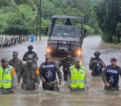
- Rainbands have already spread over portions of the southern coast of Mexico. While the center will likely remain offshore, Carlos is close enough to bring periods of heavy rainfall to much of the Mexican Riviera at times through this weekend.
- Rainfall totals of 2 to 4 inches are expected across the southwestern coast of Mexico through Tuesday, with locally higher amounts up to 6 inches. Heavy rain may cause life-threatening flash floods and mudslides.
- Swells generated by the slowly strengthening system will generate high surf and rip currents along the Mexican Riviera coast into early next week.
- Only four other eastern Pacific hurricane seasons have recorded their third named storm by June 11.
- This is also the second earliest occurrence of the third hurricane in the eastern Pacific on record.
Hurricane Carlos formed Saturday over the Pacific Ocean south of Acapulco, Mexico, prompting a hurricane watch to be issued for a swath of that country . . .

