National Civil Protection reported that Hurricane Kay, category 1, is located southwest of the coast of Jalisco. The cloud bands of the system cause torrential rains, winds with strong gusts, and high waves on the coasts of the western states of the country.
The cyclone, according to the agency, has maximum sustained winds of 130 km/h and maximum wind gusts of 155 km/h.
The unit asks “extreme precautions to the general population of the states on alert for rain, wind, and waves (including maritime navigation) and heed the recommendations issued by the authorities of the National Civil Protection System, in each entity.”
Within the area closest to the passage of the hurricane, Civil Protection put six states in the country on alert: Center, North, and South of Baja California Sur; Center, North, South and West of Colima; Northwest and Southwest of Jalisco; Center, North, South and West of Nayarit ; Center, Center-South and South of Sinaloa; and the South and Southwest of Michoacán.
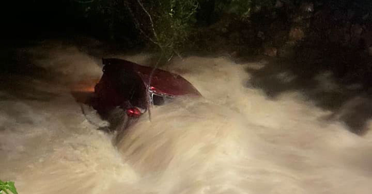
These areas, including Puerto Vallarta, are under Blue Alert, meaning low-risk but extremely important for the public to maintain attention to information. Even under low-risk, Puerto Vallarta has already experienced damages and flooding, these scenarios will continue for the next couple of days.
Municipalities on alert
These entities cover 70 municipalities with the blue alert, among which are 22 from Jalisco:
- Jalisco: Atengo, Atenguillo, Autlán de Navarro, Ayutla, Cabo Corrientes, Casimiro Castillo, Cihuatlán, Cuautitlán de García Barragán, Cuautla, El Grullo, Guachinango, La Huerta, El Limón, Mascota, Mixtlán, Puerto Vallarta, Villa Purificación, San Sebastián of the West, Talpa de Allende, Tolimán, Tomatlán, Tuxcacuesco.
- Baja California Sur: Comondú, Mulegé, La Paz, Los Cabos, Loreto.
- Colima: Armory, Colima, Comala, Coquimatlán, Cuauhtémoc, Ixtlahuacán, Manzanillo, Minatitlán, Tecomán, Villa de Álvarez.
- Nayarit: Acaponeta, Ahuacatlán, Amatlán de Cañas, Compostela, Huajicori, Ixtlán del Río, Jala, Xalisco, Rosamorada, Ruíz, San Blas, San Pedro Lagunillas, Santa María del Oro, Santiago Ixcuintla, Tecuala, Tepic, Tuxpan, Bahía de Banderas .
- Sinaloa : Concordia, Cosalá, Culiacán, Elota, Escuinapa, Mazatlán, Rosario, San Ignacio, Navolato.
- Michoacán: Aquila, Arteaga, Coahuayana, Chinicuila, Lázaro Cárdenas, Tumbiscatío.
The effects:
Wind
Winds with gusts of 90 to 110 km / h on the coasts of Jalisco, Colima, and Michoacán.
Wind with gusts of 60 to 80 km/h on the coasts of Sinaloa, Nayarit, and Guerrero.
Rain
Punctual torrential rains (from 150 to 250 mm): in Sinaloa, Nayarit, Colima and Michoacán.
Intense punctual rains (from 75 to 150 mm): in Jalisco.
Very strong punctual rains in Guerrero.
Surf
Waves of 3 to 5 meters high on the coasts of Jalisco, Colima, and Michoacán.
Waves of 1 to 3 meters high on the coasts of Guerrero, Nayarit, and Baja California Sur.
National Civil Protection reported that Hurricane Kay, category 1, is located southwest of the coast of Jalisco. The cloud bands of the system cause . . .


