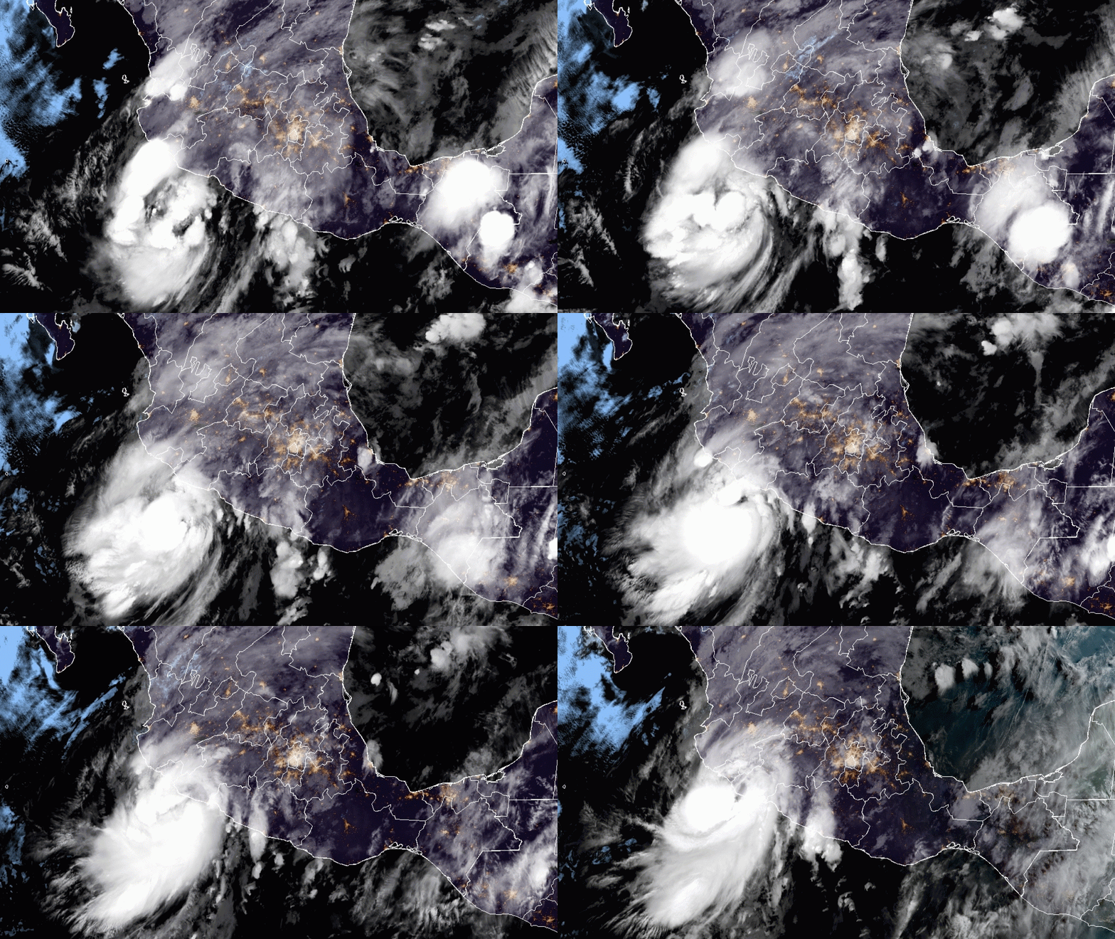
This Saturday, July 19, the center of the Tropical Storm “Dolores” will make landfall between the coasts of Michoacán and Colima, and will cause extraordinary rains in Jalisco, Colima, and Michoacán, torrential rains in Nayarit and Guerrero, and very strong in Sinaloa, Durango, and Guanajuato.
UPDATE: TROPICAL STORM DOLORES IS MAKING LANDFALL NOW NEAR THE BORDER OF MICHOACAN AND COLIMA
The rains could generate landslides, overflowing rivers, and floods in low parts of the land. Also, gusts of wind of 90 to 110 km / h, waves of 3 to 5 meters of significant height, and possible formation of waterspouts are expected on the coasts of Jalisco, Colima, and Michoacán.
Extraordinary rains (greater than 250.0 mm): Jalisco, Colima and Michoacán. Intense rains (150. 1 to 250.0 mm): Nayarit and Guerrero. Heavy rains (50.1 to 75.0 mm): Sinaloa, Durango, Guanajuato and Chiapas.
At 700 AM CDT (1200 UTC), the center of Tropical Storm Dolores was located near latitude 17.9 North, longitude 103.4 West. Dolores is moving faster toward the north-northwest near 13 mph (20 km/h), and this motion is expected to continue until landfall. Dolores is forecast to make landfall along the southwestern coast of Mexico within the next few hours.
Maximum sustained winds have increased to near 65 mph (100 km/h) with higher gusts. Additional intensification is possible prior to landfall, and Dolores is forecast to be near hurricane intensity when it makes landfall later today. Rapid weakening is expected after landfall, and Dolores is expected to dissipate by the end of the weekend.
Tropical-storm-force winds extend outward up to 105 miles (165 km) from the center.
WIND: Tropical storm conditions are likely occurring within the warning area, and outside preparations should be complete. Hurricane conditions are possible within the hurricane watch area within the next few hours. Tropical storm conditions are possible within the tropical storm watch area this evening through Sunday morning.
RAINFALL: Tropical Storm Dolores will produce heavy rainfall of 6 to 10 inches with isolated maximum amounts of 15 inches across coastal sections of the Mexican states of Guerrero, Michoacan, Colima, Jalisco, and Nayarit through the weekend. This will likely produce life-threatening flash flooding and mudslides.
Additionally, 3 to 5 inches of rainfall with isolated maximum amounts of 8 inches are expected for western Oaxaca, as well as southern Sinaloa. This may produce life-threatening flash flooding.
STORM SURGE: A storm surge is expected to produce coastal flooding near and to the east of where the center makes landfall. Near the coast, the surge will be accompanied by large and destructive waves.
SURF: Swells generated by Dolores will affect portions of the southwestern coast of Mexico through the weekend. These swells are likely to cause life-threatening surf and rip current conditions.