Tropical Storm Flossie gains strength off southwestern Mexico, with hurricane status possible by Tuesday. Storm warnings issued from Punta San Telmo to Playa Perula.
Tropical Storm Flossie continues to gain strength off Mexico’s Pacific coastline, prompting tropical storm warnings and watches across several southwestern states. According to the National Hurricane Center (NHC), Flossie is expected to intensify into a hurricane later tonight or by Tuesday, bringing heavy rainfall, dangerous surf, and the threat of flooding to parts of the country.
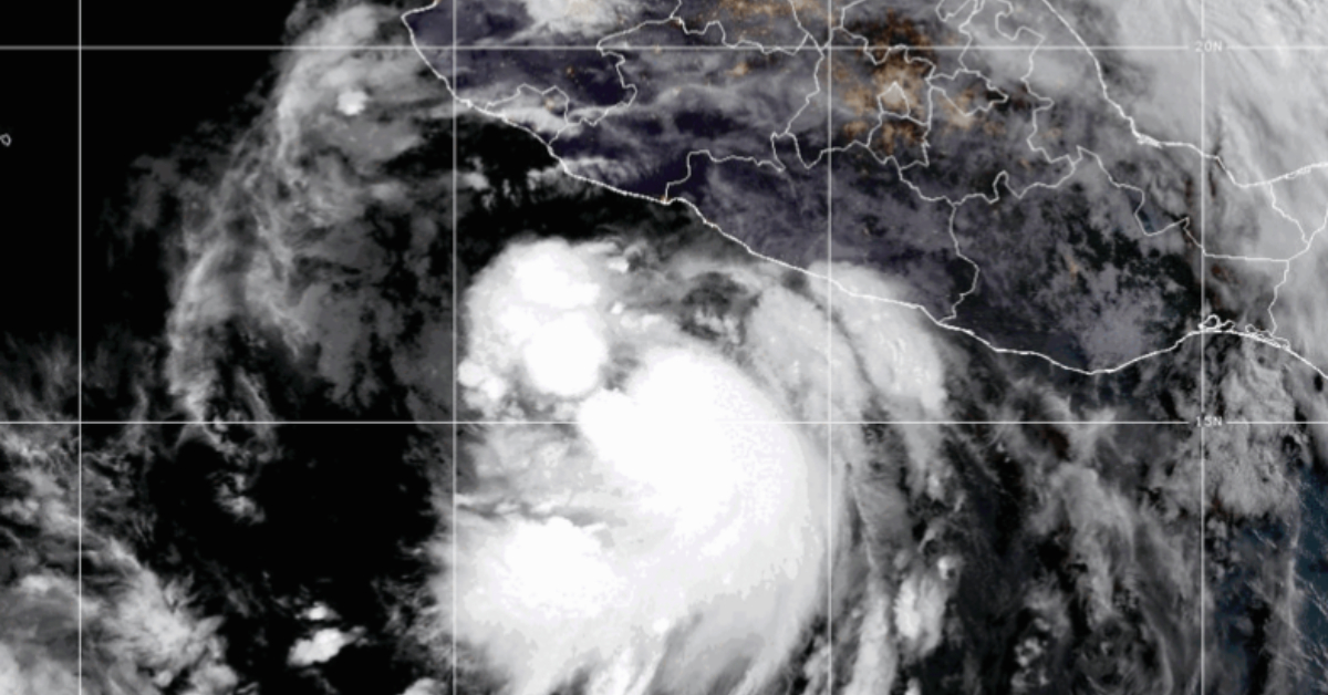
As of 9:00 a.m. CST on Monday, the center of Flossie was located approximately 160 miles (255 km) south-southwest of Zihuatanejo and about 260 miles (420 km) south-southeast of Manzanillo. The storm is moving northwest at 10 mph (17 km/h) with sustained winds of 60 mph (95 km/h), and higher gusts have been reported. Its minimum central pressure is estimated at 998 millibars (29.47 inches).
Warnings and Watches in Effect
A Tropical Storm Warning is now active from Punta San Telmo to Playa Perula, meaning tropical storm conditions are expected within the warning area in the next 36 hours.
In addition, a Tropical Storm Watch has been issued from Zihuatanejo to east of Punta San Telmo, as well as north of Playa Perula to Cabo Corrientes. These areas could experience tropical storm conditions within 48 hours.
Residents in these regions are urged to monitor official updates and prepare for potential high winds, heavy rains, and coastal hazards.
Rainfall and Flooding Threat
The storm is expected to produce 3 to 6 inches of rain, with isolated areas possibly receiving up to 10 inches across the states of Oaxaca, Guerrero, Michoacán, Colima, and Jalisco through Wednesday.
The NHC warns that this level of rainfall could lead to isolated life-threatening flash floods and mudslides, particularly in mountainous terrain and steep landscapes.
Dangerous Surf Conditions Expected
Swells generated by Flossie are already beginning to affect parts of the southwestern coast and will likely increase in intensity through midweek. These swells can produce life-threatening surf and rip current conditions. Beachgoers and coastal residents are advised to avoid entering the water and heed local safety advisories.
Forecast and Outlook
Flossie is expected to continue on a northwest to west-northwest path over the next several days, potentially hugging the coastline before curving out to sea. However, any deviation in its current trajectory could bring the storm closer to land, increasing the risk of direct impacts in coastal communities.
The NHC forecasts that Flossie will strengthen steadily, possibly rapidly, over the next 24 to 48 hours. If this trend continues, the storm will become a Category 1 hurricane by Tuesday, with further intensification possible depending on environmental conditions.
Tropical-storm-force winds are currently extending outward up to 70 miles (110 km) from the center of the storm.
Preparedness and Monitoring
Local governments in the affected regions are likely to activate civil protection protocols and emergency services. Residents should secure property, prepare emergency kits, and stay informed through local authorities and official weather channels.
Travelers and tourists in the region should monitor weather updates closely and adjust their plans if necessary, especially in coastal cities like Zihuatanejo, Lázaro Cárdenas, and Manzanillo.
For detailed forecasts, storm graphics, and emergency alerts, visit the National Hurricane Center at hurricanes.gov or follow updates from Mexico’s Servicio Meteorológico Nacional.
Next Update:
The NHC will release its next intermediate advisory at 12:00 p.m. CST, followed by a complete advisory at 3:00 p.m. CST.
Stay tuned for continued coverage as Tropical Storm Flossie advances.
Tropical Storm Flossie gains strength off southwestern Mexico, with hurricane status possible by Tuesday. Storm warnings issued from Punta San Telmo to . . .


")


