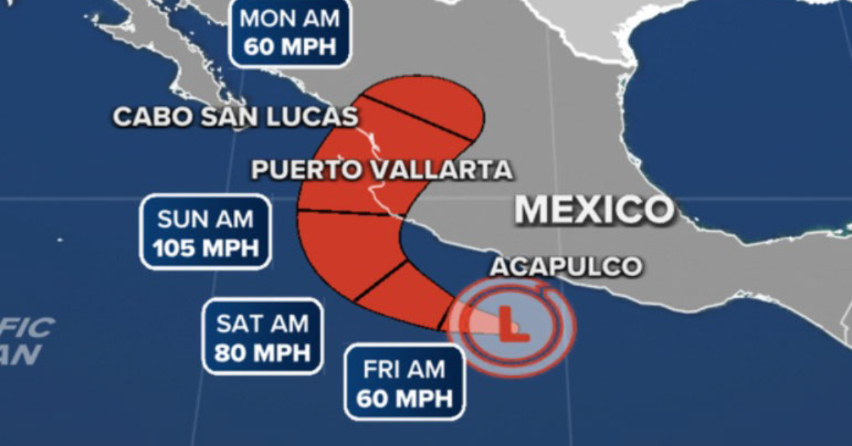
Roslyn has intensified further during the past several hours, as the hurricane continues to show a small well-defined eye inside of a cold central dense overcast with an increase to a category 4 storm. What effects would it have in Puerto Vallarta . . .