
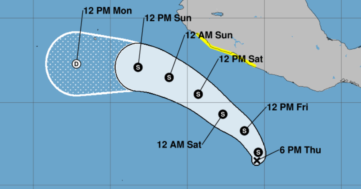
The Mexican government has issued a Tropical Storm Watch along its Pacific coast, extending from Tecpan De Galeana in Guerrero to Manzanillo in Colima. Authorities anticipate tropical storm conditions may affect the area within the next 48 hours.
As of 3:00 PM CST, the weather disturbance, currently designated as Potential Tropical Cyclone Four-E, was located approximately at latitude 11.3 North, longitude 100.2 West. It is moving west-northwest at around 7 mph (11 km/h). Forecasters expect the system to continue this motion, potentially strengthening into a tropical storm by Friday.
Current maximum sustained winds are around 35 mph (55 km/h), but significant strengthening is likely over the coming days. The system poses a 90% chance of developing into a tropical storm within the next 48 hours, continuing to strengthen while moving parallel to the southwestern coast of Mexico.
Rainfall projections for the states of Guerrero, Michoacán, and Colima indicate totals ranging between 2 to 4 inches, with isolated locations possibly receiving up to 6 inches through the weekend. Authorities caution residents about potential flooding and mudslides triggered by heavy rainfall.
Additionally, the storm is expected to generate dangerous ocean conditions. Swells caused by the system could lead to life-threatening surf and rip currents along the coast in the watch area. Residents and visitors are advised to closely monitor local weather updates and heed any safety instructions from authorities.
For detailed information specific to local areas, residents should consult updates provided by Mexico’s national meteorological service.


