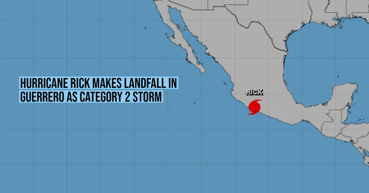
At 5:00 am this Monday, Hurricane Rick made landfall near the municipality of La Unión Isidoro Montes de Oca, Guerrero ; about 25 kilometers east of Lázaro Cárdenas, Michoacán. This was reported in a statement by the National Meteorological Service (SMN).
“The center of Hurricane Rick, category two on the Saffir-Simpson scale, made landfall in the vicinity of the municipality of La Unión de Isidoro Montes de Oca, Guerrero, at 05:00 (Central Mexico time). It is located on land 25 kilometers east of Lázaro Cárdenas, Michoacán, and 55 kilometers northwest of Zihuatanejo, Guerrero,” wrote the climate agency.
The powerful storm registers maximum sustained winds of 165 kilometers per hour, with gusts over 210 km / h, and is heading very slowly towards the north.
Due to the approach of the system, the National Civil Protection Coordination issued alerts in 11 states and 712 municipalities, through the Early Warning System (SIAT-CT). The entities in which the greatest impacts are expected today are Guerrero, Michoacán, Colima, and Jalisco; although alerts were also activated in the State of Mexico, Guanajuato, Morelos, Nayarit, Zacatecas, Oaxaca, and Puebla.
In the next few hours, Rick will drop significant rains in all of the states mentioned. The largest accumulations are forecast in Michoacán and Guerrero, with torrential records that will exceed 250 millimeters.
In addition, in Jalisco and Colima, the rainfall will be intense, from 75 to 150 millimeters, while in Guanajuato it will range from 50 to 75 millimeters. Querétaro, the State of Mexico, Puebla, Morelos, Oaxaca, Veracruz, Chiapas, and Tabasco will not be spared from the rains and in their territories, Rick’s cloud bands could leave up to 50 millimeters.
According to the SMN, it will also be necessary to be aware of the winds that can be damaging in western Mexico, especially the coastal nuclei of Michoacán and Guerrero. There the gusts could reach up to 150 kilometers per hour this Monday and a little further north, in Colima, they will be of the order of 70 to 80 km / h.
On the beaches of the Mexican Pacific, the maritime conditions will be adverse. The waves could rise up to seven meters high in Michoacán and Guerrero. In Colima, they will be between one and three meters.
It is expected that in Michoacán the storm will degrade into a tropical storm, with winds that will go from 65 to 118 kilometers per hour. Overnight on Monday, and the early hours of Tuesday, the system would arrive in Jalisco, entering through Cotija.
At 5:00 am this Monday, Hurricane Rick made landfall near the municipality of La Unión Isidoro Montes de Oca, Guerrero ; about 25 . . .


