Some coastal areas are more prone to devastating hurricanes – a meteorologist explains why

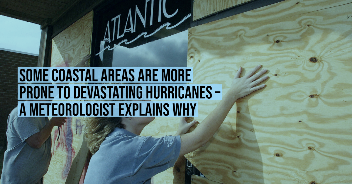
Every coastline in the North Atlantic is vulnerable to tropical storms, but some areas are more susceptible to hurricane destruction than others.

To understand why as the region heads into what’s forecast to be another busy hurricane season, let’s look more closely at how tropical storms form and what turns them into destructive monsters.

Ingredients of a hurricane

Three key ingredients are needed for a hurricane to form: warm sea surface water that’s at least about 80 degrees Fahrenheit (26.5 C), a thick layer of moisture extending from the sea surface to roughly 20,000 feet and minimal vertical wind shear so the thunderstorm can grow vertically without interruption.

These prime conditions are often found in the tropical waters off the west coast of Africa.

Storm tracks show the curved track from Africa into the Gulf of Mexico and out to the ocean.
Twenty-five years of Atlantic tropical storm tracks, ranging from tropical depressions in dark blue to hurricanes in yellows and reds.
Nilfanion

Hurricanes can also form in the Gulf of Mexico and the Caribbean, but the ones that start close to Africa have thousands of miles of warm water ahead that they can draw energy from as they travel. That energy can help them grow into powerful hurricanes.

Wind currents set most tropical storms on a course westward from Africa toward the Caribbean, Florida and the Gulf of Mexico. Some drift northward into the midlatitudes, where the prevailing winds shift from west to east and cause them to curve back out into the Atlantic.

Others encounter cooler ocean temperatures that rob them of fuel, or high wind shear that breaks them apart. That’s why tropical cyclones rarely hit northern states or Europe, though it does happen.

Map showing return periods for coastal counties
The numbers shown here reflect how often a hurricane would be expected within 50 nautical miles. The red dots suggest a hurricane every five to seven years.
NOAA

Time of season also influences hurricane paths

Early in the season, in June and July, sea surface temperatures are still warming and atmospheric wind shear slowly decreases across the open Atlantic. Most early-season hurricanes develop in a small area of the Caribbean and Gulf of Mexico where prime conditions begin early.

They typically form close to land, so coastal residents don’t have much time to prepare, but these storms also don’t have ideal conditions to gain strength. Texas, Louisiana and Mississippi, as well as Central America, are more likely to see hurricane strikes early in the season, as the trade winds favor an east-to-west motion.

As surface waters gain heat over the summer, hurricane frequency and severity begin to increase, especially into the peak hurricane months of August through October.

Toward the end of the season, trade winds begin to shift from west to east, ocean temperatures start to fall, and cold fronts can help divert storms away from the western Gulf and push them toward the Florida Panhandle.

Maps of storm activity by month
The busiest areas during each month of hurricane season.
NOAA

Shape of the seafloor matters for destructiveness

The shape of the seafloor can also play a role in how destructive hurricanes become.

Hurricane strength is currently measured solely on a storm’s maximum sustained wind speeds. But hurricanes also displace ocean water, creating a surge of high water that their winds push toward shore ahead of the storm.

This storm surge is often the greatest threat to life and property from a hurricane, accounting for about 49% of all direct fatalities between 1963 and 2012. Hurricane Katrina (2005) is a prime example: An estimated 1,500 people lost their lives when Katrina hit New Orleans, many of them in the storm surge flooding.

If the continental shelf where the hurricane hits is shallow and slopes gently, it generally produces a greater storm surge than a steeper shelf.


How the shape of the seafloor affects a hurricane storm surge.

As a result, a major hurricane hitting the Texas and Louisiana Gulf Coast – which has a very wide and shallow continental shelf – may produce a 20-foot storm surge. However, the same hurricane might produce only a 10-foot storm surge along the Atlantic coastline, where the continental shelf drops off very quickly.

Where are the hurricane hot spots?

A few years ago, the National Oceanic and Atmospheric Administration analyzed the probability of U.S. coastlines’ being hit by a tropical storm based on storm hits from 1944 and 1999.

It found that New Orleans had about a 40% chance each year of a tropical storm strike. The chances rose for Miami and Cape Hatteras, North Carolina, both at 48%. San Juan, Puerto Rico, which has seen some devastating storms in recent years, was at 42%.

Hurricanes, which have sustained wind speeds of at least 74 miles per hour, were also more frequent in the three U.S. locations. Miami and Cape Hatteras were found to have a 16% chance of a direct hit by a hurricane in any given year, and New Orleans’ chance was estimated at 12%.

Each of these locations is vulnerable to a hurricane because of its location, but also its shape. North Carolina and Florida “stick out like a sore thumb” and are often grazed by hurricanes that curve up the east coast of the U.S.

A map of storm probabilities over the Atlantic coasts
The probability that a named storm tropical storm or hurricane will affect a location at some point during hurricane season.
Todd Kimberlain/AOML NOAA

Climate change changes the risk

As sea surface temperatures rise with the warming of the planet, more areas outside of these usual hurricane regions may see more tropical storms.

I analyzed tropical cyclones in the North Atlantic that made landfall from 1972 to 2019 to look for changes over the past half-century.

During the first six years of that period, 1972-77, the Atlantic averaged four direct hits per year. Of those, 75% were in the usual hurricane-prone areas, such as the Southern United States, the Caribbean and Central America. Six storms made landfall elsewhere, including New England, Canada and the Azores.

By 2014-19, the Atlantic averaged 7.6 direct hits per year. While the U.S. took the majority of those hits, Europe has been showing a steady increase in cyclones making landfall. Major hurricanes – those with sustained wind speeds of 111 miles per hour and above – are also more common than they were in the 1970s and ‘80s.

While southern coastal locations of the United States may be the most vulnerable to tropical cyclone impacts, it is important to understand that a devastating cyclone can hit anywhere along the Atlantic and Gulf coasts.

The National Hurricane Center is forecasting another busy season in 2021, though it is not expected to be as extreme as 2020’s record 30 named storms. Even if an area hasn’t experienced a hurricane in several years, residents are advised to prepare for the season as if their area will take a hit – just in case.


Athena Masson, Meteorology instructor, University of Florida

This article is republished from The Conversation under a Creative Commons license. Read the original article.

Every coastline in the North Atlantic is vulnerable to tropical storms, but some areas are Continue reading

Follow Us On Google News | Get Our Newsletter


Trending News on PVDN

  • cancun-beaches-50-tons-sargassum-cleanupCancún beach overwhelmed by over 50 tons of sargassum in 24 hours Over 50 tons of sargassum were removed from Cancún’s Chac Mool Beach in just 24 hours, as authorities ramp up cleaning efforts across three key public beaches. Cancún’s white-sand beaches are under pressure once again as an unusually large volume of sargassum has washed ashore in the last 24 hours, disrupting tourism and triggering a…
  • cancun-hotels-sargassum-cleanup-failuresCancún government demands answers from hotels on sargassum cleanup failures Mayor Ana Paty Peralta will meet with hotel leaders in Cancún to address failures in sargassum cleanup efforts, amid growing environmental and public health concerns. The municipal government of Benito Juárez is taking a firmer stance on the growing sargassum problem in Cancún, calling on the hotel industry to explain its inadequate handling of seaweed…
  • sargassum-slams-cancun-playa-restaurantsSargassum Crisis in Cancún and Playa del Carmen Forces Restaurants and Beach Clubs to Cut Staff Businesses in Cancún and Playa del Carmen report steep losses due to sargassum, with restaurants losing diners and beach clubs sending staff on unpaid leave. Restaurants and beach clubs along the shores of Puerto Juárez in Cancún and Playa del Carmen are grappling with a sharp downturn in business due to a relentless invasion of…
  • Body with signs of crocodile attack found in Ameca River, a leg was found last monthBeaches Closed in Nuevo Vallarta and Lo de Marcos After Crocodile Sighting Authorities temporarily close beaches in Nuevo Vallarta and Lo de Marcos after a crocodile was spotted in shallow waters. Tourists are urged to follow lifeguard guidance. Beaches in Nuevo Vallarta and Lo de Marcos were temporarily closed to the public on Friday, June 20, after a crocodile was spotted swimming close to shore, prompting swift…
  • sargassum-free-beaches-quintana-roo-summer-2025Sargassum-Free Beaches in Quintana Roo for Summer 2025, including beaches in Cancún Travelers looking for sargassum-free beaches in Quintana Roo this summer can still find clear waters in Isla Mujeres and parts of Cancún, according to updated reports. As the summer travel season ramps up, much of the Caribbean coast is once again dealing with sargassum, the brown seaweed that washes ashore in thick mats and affects…
  • Cancún Steps Up Strategy as 40 Tonnes of Sargassum Removed in One DayCancún sargassum removal hits 40 tonnes in one day as beach cleanup expands Cancún steps up sargassum removal efforts with 40 tonnes cleared from beaches in a single day, signaling a more aggressive approach to protect tourism. City officials in Cancún ramped up their beach cleaning efforts this week, clearing 40 tonnes of sargassum from Playa Chac Mool in just one day, one of the largest single-day removals…
  • baja-california-sur-violence-2025Violent Weekend in Baja California Sur Leaves 10 Dead and Sparks Public Fear Baja California Sur faced one of its deadliest weekends in 2025, with 10 people killed during violent clashes in La Paz, Comondú, and Loreto, including innocent victims. Baja California Sur endured one of the bloodiest weekends of 2025, as a wave of violence swept through the municipalities of La Paz, Comondú, and Loreto. In under…
  • cancun-hotels-sargassum-cleanup-failuresCancun Weekly Sargassum Outlook (June 24–30, 2025) Sargassum levels across the Caribbean continue to rise as the 2025 season peaks. Tourists heading to Cancún or Isla Mujeres this week should be prepared for varying beach conditions. Here’s what to expect. 📡 Offshore Conditions Satellite data from the University of South Florida reports the Great Atlantic Sargassum Belt has reached record levels this…
  • puerto-vallarta-flooding-landslide-hurricane-erickHeavy rains flood Puerto Vallarta streets and trigger landslide in tunnel Flooding from remnants of Hurricane Erick paralyzed key roads in Puerto Vallarta and caused a landslide in the Luis Donaldo Colosio tunnel, Civil Protection continues damage assessment. The city of Puerto Vallarta was overwhelmed Thursday night by heavy rainfall that caused major flooding, stranded vehicles, and triggered a landslide in the Luis Donaldo Colosio bypass…
  • bus-crashes-canal-puerto-vallartaBus crashes into canal in Puerto Vallarta’s 5 de Diciembre neighborhood A public transport bus crashed into a drainage canal in Puerto Vallarta’s 5 de Diciembre area. Authorities responded quickly, and no serious injuries were reported. A public transport bus veered off the road and plunged into a stormwater canal early Thursday morning in Puerto Vallarta’s 5 de Diciembre neighborhood, sparking concern among locals but leaving…
Scroll to Top