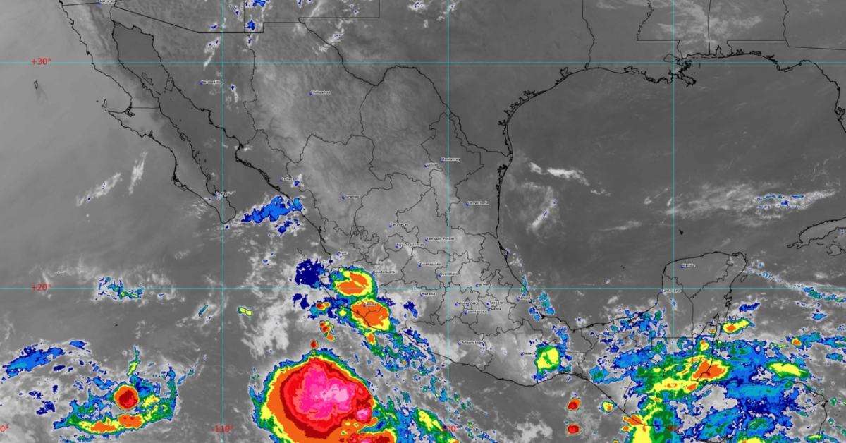
PUERTO VALLARTA (PVDN) – The first cyclone of the season is anticipated to make landfall on the Pacific Ocean coasts, as reported by the National Meteorological System. The system has identified a low-pressure zone, known as tropical wave number 6, near the coasts of Oaxaca and Guerrero, with a high likelihood of evolving into the season’s first cyclonic system.
Radar imagery places the low-pressure zone approximately 535 kilometers south of Puerto Escondido, Oaxaca. Current forecasts predict the system will veer towards the west-northwest, closely skirting the coastlines of Colima and Michoacán. The National Water Commission confirmed in a statement that as of last Saturday night, there was a 40% chance of a cyclone forming within the next 48 hours, which is likely to soar to 90% within a week.
Simultaneously, the country is bracing for the effects of tropical wave number 7, originating from the southeastern region, particularly the Yucatan peninsula. This convergence of weather systems implies substantial and widespread rainfall for various states.
Effects of both tropical wave numbers 6 and 7 became evident on Saturday night and Sunday morning, causing extensive and heavy rains of 150 to 250 millimeters in Chiapas, Oaxaca, Tabasco, and Veracruz. Intense rainfall (75 to 150 mm) occurred in Campeche, Guerrero, and Yucatán, with very heavy rainfall (50 to 75 mm) in Puebla and Quintana Roo. Chihuahua, Durango, and Sinaloa also received significant rainfall (25 to 50 mm), and lighter showers were recorded in Mexico City, the State of Mexico, Hidalgo, Michoacán, and Morelos.
Severe conditions, including electrical storms, powerful wind gusts, dust storms, and hailstorms, are expected to accompany the heaviest rainfall. These rains may provoke landslides, rising river and stream levels, and flooding in low-lying areas of the aforementioned states.
While the state of Jalisco is not expected to experience heavy rain, it will likely receive light overnight and early morning showers, particularly in the mountainous, coastal, and southern regions. The state will also be subjected to powerful wind gusts of 60 to 80 kilometers per hour and possible dust storms, which are also predicted to affect Aguascalientes, Baja California, Baja California Sur, Chihuahua, Coahuila, Durango, Guanajuato, Nuevo León, San Luis Potosí, Tamaulipas, and Zacatecas.
Moreover, as the hot season sets in, temperatures are expected to hover between 40 and 45 degrees Celsius in Baja California, Chihuahua, Durango, Guerrero, Jalisco, Michoacán, Nayarit, San Luis Potosí, Sinaloa, Tamaulipas, and Veracruz, while temperatures between 35 and 40 degrees Celsius will grip Campeche, Colima, the southwest of the State of Mexico, Guanajuato, Hidalgo, Morelos, Querétaro, Quintana Roo, Puebla, Yucatán, and Zacatecas. States such as Aguascalientes, Chiapas, Oaxaca, and Tabasco will see temperatures between 30 and 35 degrees Celsius, with Baja California Sur, Coahuila, Nuevo León, and Sonora exceeding 45 degrees Celsius.
As the country braces itself for these extreme weather conditions, residents are urged to take necessary precautions to stay safe.
PUERTO VALLARTA (PVDN) - The first cyclone of the season is anticipated to make landfall on the Pacific Ocean coasts, as reported by the National . . .


