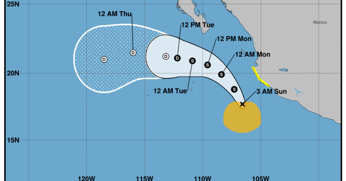
Madeline is located off the coasts of Colima and Jalisco, moving toward the north near 8 mph (13 km/h). A gradual turn toward the northwest and then the west is expected through early this week.
Currently, a Tropical Storm Watch is in effect from Manzanillo to Cabo Corrientes, south of Puerto Vallarta.
Maximum sustained winds are near 45 mph (75 km/h) with higher gusts. Some slight strengthening is possible over the next day or so. Weakening is forecast to begin later this week.
Tropical-storm-force winds extend outward up to 150 miles (240 km) from the center.
RAINFALL: Outer bands from Madeline are forecast to produce rainfall totals of 3 to 6 inches with local maximum totals of 8 inches today into Monday across mainly coastal portions of the following Mexican States: Colima, Jalisco, and Nayarit.
These heavy rains may produce localized flash and urban flooding, along with possible mudslides in areas of higher coastal terrain.
WIND: Tropical storm conditions are possible within the watch area today through Monday.
SURF: Swells generated by Madeline will affect portions of the southwest coast of Mexico for the next few days. High surf associated with Madeline will spread northward and begin to affect the coast of Baja California today into Monday. These swells are likely to cause life-threatening surf and rip current conditions.
Madeline is located off the coasts of Colima and Jalisco, moving toward the north near 8 mph (13 km/h). A gradual turn toward . . .


