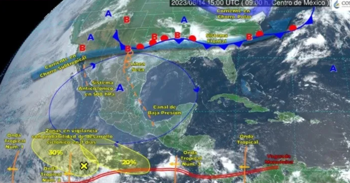
PUERTO VALLARTA (PVDN) – The National Meteorological Service (SMN) is monitoring two low-pressure areas in the Mexican Pacific, each carrying a 20% probability of cyclonic development, according to a recent statement. Currently situated off the southern coast of Mexico, these zones of instability do not pose an immediate threat to the national coasts.
The SMN, an agency of the National Water Commission (Conagua), anticipates the formation of a low-pressure area south of the Oaxaca and Guerrero coasts, carrying a 20% cyclonic development probability over the next seven days.
The second area, currently located 1,035 kilometers south-southwest of Manzanillo, Colima, presents a 30% probability for cyclonic development in the next 48 hours, reducing to 20% in the forthcoming week. This system is moving to the west-northwest at a speed of between 16 and 24 kilometers per hour.
An anticyclonic circulation in the middle atmospheric levels is maintaining the third heatwave across all 32 states, with temperatures rising above 30 degrees Celsius. Meanwhile, the combination of the low-pressure channel, divergence in height, and moisture ingress from the Pacific, Gulf of Mexico, and Caribbean Sea are expected to cause rains in areas of Oaxaca and Chiapas.
Notably, meteorological platform meteored.com reported an increase in instability in the Pacific waters, far south of the national territory. The United States National Hurricane Center is beginning to monitor the low-pressure areas, predicting a 20% chance of developing into tropical cyclones by the end of this week. However, with their trajectories set over 500 km from the coasts, their impact is anticipated to be minimal.
Nevertheless, changes are expected this weekend with the arrival of an active tropical wave. The possible tropical wave, identified as number 3, is predicted to trigger heavy rains and storms in Chiapas, Oaxaca, and Guerrero, persisting into the weekend. While this wave could evolve into a tropical cyclone, it is expected to remain offshore from Mexico. However, its circulation is projected to enhance rainfall in the south and southeast regions of the country.
The current forecasts indicate an increasing trend in rainfall, primarily in the central-southern half of the country, as more waves and cyclones become active. Residents are urged to remain vigilant and monitor updates from local weather agencies.
PUERTO VALLARTA (PVDN) - The National Meteorological Service (SMN) is monitoring two low-pressure areas in the Mexican Pacific, each carrying a 20% probability of . . .


")


")
