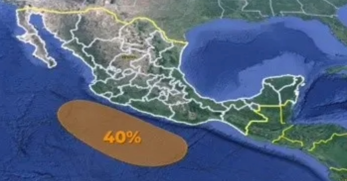
Puerto Vallarta, Mexico – The National Weather Service has issued a surveillance alert for the potential formation of a low-pressure zone that could develop into a tropical cyclone in the Pacific Ocean. This development is being closely monitored due to its possible impact on several states along the Mexican coast, including Jalisco.
According to the latest data, the area of concern is expected to form off the coasts of Jalisco, Colima, Michoacán, Guerrero, and Oaxaca. There is a 40% probability that this low-pressure zone will evolve into a tropical cyclone within the next seven days.
For now, residents in the Central Pacific regions can expect partly cloudy to cloudy skies. There is also a forecast for electric storms and the possibility of hail in areas experiencing rain. Morning conditions will bring cool weather and fog banks in the mountainous areas, while the afternoons are predicted to be hot.
Wind conditions are expected to vary, with a general direction of 10 to 20 km/h across the region. However, gusts could reach 50 to 70 km/h in Jalisco, potentially causing dust storms. Similarly, Michoacán could experience wind gusts of 40 to 60 km/h with possible dust storms.
Residents and local authorities in the affected areas are advised to stay informed through official channels and be prepared for any changes in weather conditions that may occur over the coming days. The National Weather Service will continue to provide updates as the situation develops.
Puerto Vallarta, Mexico - The National Weather Service has issued a surveillance alert for the potential formation of a low-pressure zone that could develop into a tropical cyclone in the Pacific Ocean. This development is being closely monitored due to its possible impact on several states along the Mexican coast, including Jalisco.


