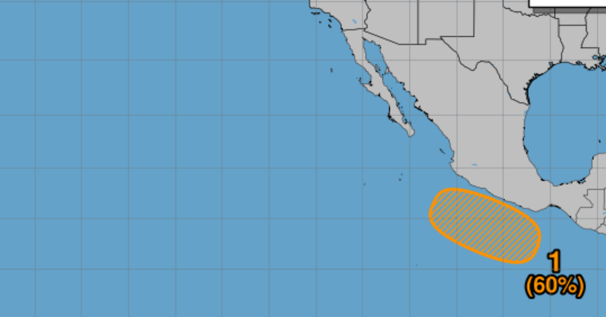
NOAA forecasts a 60% chance for a new low-pressure system off southern Mexico to develop into Tropical Storm Barbara, marking the second named storm of the Eastern Pacific season. An area of low pressure is forecast to form offshore of the coast of southern Mexico late this week as forecasters begin monitoring conditions that could give rise to the second named storm of the 2025 Eastern Pacific hurricane season. Initial satellite and model data show...
An area of low pressure is forecast to form offshore of the coast of southern Mexico late this week as forecasters begin monitoring conditions that could give rise to the second named storm of the 2025 Eastern Pacific hurricane season. Initial satellite and model data show that sea surface . . .
Follow Us On Google News | Get Our Newsletter


