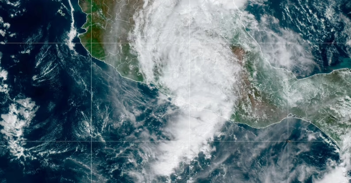
Puerto Vallarta, Mexico – In an unprecedented turn of events, Hurricane ‘Otis’ escalated from a tropical storm to a Category 5 hurricane in just over 40 hours, catching scientists and climate specialists off guard. The phenomenon occurred without any prior characteristics that could have hinted at its rapid intensification. The hurricane left a devastating trail in its wake, causing more than 40 casualties, extensive damage to infrastructure, and crippling telecommunications.
Benjamín Martínez López, a senior researcher in the Department of Atmospheric Sciences at the Institute of Sciences of Atmosphere and Climate Change (ICAyCC) of the National Autonomous University of Mexico (UNAM), expressed concern over the future recurrence of such extraordinary events. “Everything indicates that sea temperatures will increase even more, so it seems so. At least in the coming years we are on an increasing trend. We can expect more heat waves in the oceans, more energy to be stored, and the ingredient of very high temperatures is there, which favors the intensification of hurricanes. Especially those in category 3 and 4, who go to a higher level,” López told the UNAM Gazette.
While it is uncertain exactly when similar phenomena will occur, the senior researcher did not rule out the possibility of their recurrence. “We have to wait if they start to appear next year or in two, and when several years pass we could have more certainty to say: be careful, because it could arrive more frequently,” he cautioned.
Dr. Jorge Zavala Hidalgo, the director of the Institute of Atmospheric Sciences and Climate Change at UNAM, elucidated on the conditions that might have contributed to the swift escalation of Hurricane ‘Otis’. One essential factor is the depth of the warm layer of the ocean, also known as the mixed layer. A shallower layer would cool more quickly, effectively weakening the hurricane. “However, if there is enough latent heat of evaporation that the cyclone can extract from the ocean, it will gain more strength,” said Hidalgo.
Moreover, the influence of the El Niño phenomenon might also have played a role. “We are experiencing a very warm year; the temperature of the Pacific is warmer at this time of year. These conditions could have influenced the intensity of Otis,” the director pointed out in an interview.
Additional contributing factors include the absence of low vapor layers in the troposphere, ranging from 8 to 12 kilometers, which would have otherwise led to intrusions of dry air that could weaken the hurricane. Another requisite for rapid intensification is favorable conditions both at lower and higher atmospheric levels that enhance cyclonic movement and air mass dispersal, respectively.
This unpredicted and fast escalation of Hurricane ‘Otis’ serves as a cautionary tale for scientists, policy makers, and the general public alike. As our understanding of the natural phenomena remains limited, so does our ability to anticipate them. This underscores the imperative need for increased research, public awareness, and preparedness strategies to mitigate future risks.
Puerto Vallarta, Mexico - In an unprecedented turn of events, Hurricane 'Otis' escalated from a tropical storm to a Category 5 hurricane in . . .


