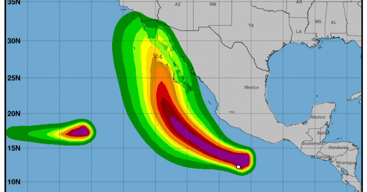
PUERTO VALLARTA (PVDN) – Tropical Storm Hilary has formed off the southern coast of Mexico, as satellite imagery indicates the system has developed a well-defined circulation and more organized convective banding features. The storm’s formation is based on the improved cloud pattern seen in recent hours, with subjective Dvorak estimates from TAFB and SAB at T1.5 and T2.0, respectively.
Currently, Hilary is moving west-northwestward at 12 knots, with its path influenced by a building ridge over the United States and a trough off the California coast. The tropical cyclone is expected to make a gradual turn to the northwest within the next 24 hours, followed by a northward turn between the trough and the ridge’s western periphery by day 3. Global model guidance is relatively well-clustered for the first 3 days, with larger cross-track differences appearing by day 4 and beyond. The official track forecast aligns closely with the simple and corrected consensus aids.
Environmental and oceanic conditions are conducive for further strengthening of the storm. Sea surface temperatures near or at a warm 30 degrees C through 72 hours, weak vertical wind shear, and moist near-storm relative humidities all contribute to favorable conditions for intensification. Statistical intensity guidance indicates high probabilities of rapid intensification in the next couple of days. The NHC expects Hilary to become a hurricane by Thursday, with rapid intensification in the first 24 hours. However, as the system is broad, it may take longer to consolidate and strengthen. The storm is expected to reach peak intensity within 60-72 hours.
By day 4, Hilary is forecasted to encounter increasing vertical wind shear and cooler waters below 26 degrees C, which will likely cause its convection to collapse, becoming post-tropical by day 5.
Key Messages:
- Tropical Storm Hilary has the potential to impact the Baja California Peninsula and parts of the southwestern United States this weekend. Although the exact location and magnitude of rainfall and wind impacts remain uncertain, interests in these areas should monitor Hilary’s progress and any updates to the forecast.
- Large swells generated by Hilary are expected to spread northward along the southwestern Mexico coast and the Baja California Peninsula in the coming days.
As the forecast continues to evolve, users are reminded not to focus solely on the exact track and intensity predictions for Hilary, especially in the latter parts of the forecast period.
PUERTO VALLARTA (PVDN) - Tropical Storm Hilary has formed off the southern coast of Mexico, as satellite imagery indicates the system has developed a well . . .


