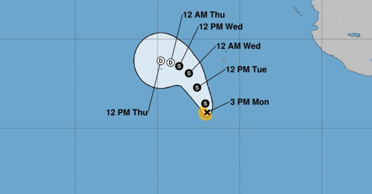
Tropical Storm Paine has formed in the Mexican Pacific, well off shore, and is moving toward the north-northwest near 6 mph (9 km/h). A northwest or north-northwest motion is expected through Tuesday night, followed by a gradual turn to the west-northwest and west on Wednesday and Thursday, away from Mexico.
Maximum sustained winds are near 40 mph (65 km/h) with higher gusts. Some slight strengthening is possible through Tuesday. Weakening is expected to begin by Tuesday night or Wednesday.
Tropical-storm-force winds extend outward up to 35 miles (55 km) from the center.
Meanwhile, all storm warning in Mexico from Hurricane Orlene have expired.
Orlene is now a tropical depression and is moving toward the north-northeast near 9 mph (15 km/h) and this motion is expected to continue through this evening. On the forecast track, the center of Orlene will move farther inland over west-central Mexico this evening.
Maximum sustained winds have decreased to near 35 mph (55 km/h) with higher gusts. Additional weakening is forecast, and Orlene is forecast to dissipate later tonight.
Hurricane Orlene made landfall on Mexico’s Pacific coast on Monday near the resort town of Mazatlán.
Power cables swayed in the wind and sent cascades of sparks through the town of El Rosario, about 65 kilometers south of Mazatlán, near where the storm hit.
Orlene lost some power while flying over the former penal colony of Islas Marias, which is being turned into a tourist attraction. The main island is sparsely populated, mostly government employees, and most buildings are made of brick and cement.
Winds from the hurricane had eased to 140 km/h when it made landfall 75 kilometers southeast of Mazatlán on Monday morning, according to the US National Hurricane Center.
Tropical Storm Paine has formed in the Mexican Pacific, well off shore, and is moving toward the north-northwest near 6 mph (9 km . . .


")


